- Ardèche River
Infobox River | river_name = Ardèche

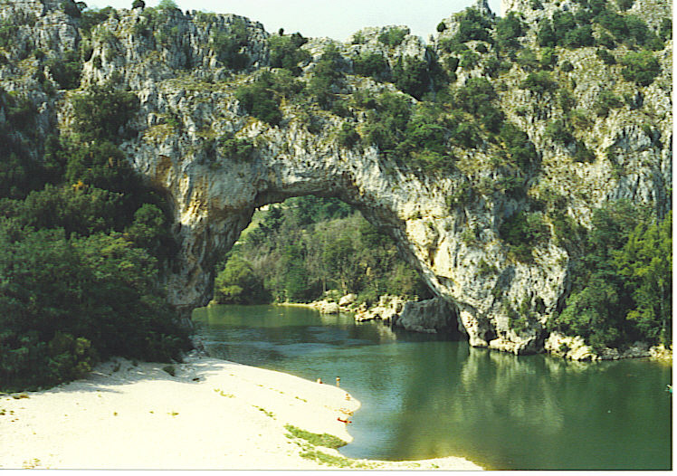
caption = Pont d'Arc over the Ardèche River.
origin =Massif Central
mouth =Rhône River
coord|44|15|52|N|4|38|53|E|name=Rhône-Durance|display=inline,title
basin_countries =France
length = 125 km
elevation =
discharge = 65 m³/s
watershed = 2,430 km²The Ardèche (Occitan : "Ardecha") is a 125 km longriver in south-centralFrance , right tributary of theRhône River . Its source is in theMassif Central , near the village ofAstet . It flows into the Rhône nearPont-Saint-Esprit , north-west of Orange. The river gives its name to theArdèche département of France.The valley of the Ardèche is very scenic, in particular a 30km section known as the Ardèche Gorges. The walls of the river here are
limestone cliff s up to 300m high. Akayak and camping trip down thegorge is not technically difficult and hugely popular in the summer, so much so that control of numbers is becoming a headache for park authorities. Fact|date=February 2007 The most famous feature is a natural 60m stone arch spanning the river simply known asPont d'Arc (arch bridge).Towns along the river
The Ardèche flows through the following "départements" and towns:
*Ardèche (named after the river):Astet ,Vals-les-Bains ,Aubenas ,Ruoms ,Vallon-Pont-d'Arc ,Saint-Martin-d'Ardèche
*Lozère
*Gard :Pont-Saint-Esprit .Tributaries
Tributaries include:
*Auzon
* Ligne
*Lignon
*Beaume
*Chassezac
*Ibie ee also
*
Chauvet Cave References
*http://www.geoportail.fr
* [http://sandre.eaufrance.fr/app/chainage/courdo/htm/V50-0400.php?cg=V50-0400 The Ardèche at the Sandre database]External links
* [http://www.trekearth.com/gallery/Europe/France/photo180175.htm Trek Earth Photo]
* [http://www.ardeche.com/en/ Welcome to Ardèche]
Wikimedia Foundation. 2010.
