- Bickley railway station
Infobox London station
name = Bickley
zone = 5
manager = Southeastern
locale =Bickley
borough = Bromley
platforms = 4
railexits0405 = 0.595
railexits0506 = 0.581
railexits0607 = 0.790
railcode = BKL
years =7 July 1858
events = Opened (terminus)
years1 =3 December 1860
events1 = ThroughBickley railway station is in the
London Borough of Bromley in southLondon . It lies between Bromley South and Swanley stations. The station and all trains are operated by Southeastern, and is inTravelcard Zone 5 .The station was opened by the
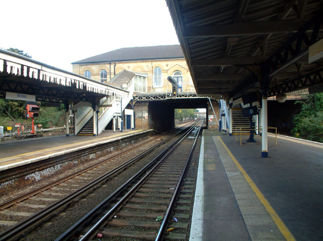
London, Chatham and Dover Railway (LCDR), on theChatham Main Line , firstly from the West (London bound) from Bromley on7 July 1858 ; and then, on3 December 1860 , the line from the east, completing the link between Victoria and Faversham, and later, in 1861, to Dover and Ramsgate. To the east of the station are what are known as the Bickley Loops which connect the "Chatham Main Line" with theSouth Eastern Main Line (of the ex South Eastern Railway, constructed in 1902 by the newley unifiedSouth Eastern and Chatham Railway .The station lies on the four-track main line, Fast and Slow lines paired; crossovers allow trains to use the Bickley Loops. There are two
island platform s, with stairs leading up to the station buildings at the country end of the station, located on Southborough Road.The station is the most vandalised station (2005/06) according to
British Transport Police [cite web|title=London station is most vandalised|publisher=BBC News Online |date=2007|url=http://news.bbc.co.uk/1/hi/england/london/6234631.stm|accessdate=2007-01-05] .Services
The typical off-peak service is:
*4tph (trains per hour) to London Victoria via Herne Hill
*2tph on Monday to Saturday to London Blackfriars via Catford and Peckham Rye
*2tph on Sundays to London Victoria via Catford and Peckham Rye
*4tph to Orpington, viaPetts Wood
*2tph to Sevenoaks viaSwanley References
External links
Wikimedia Foundation. 2010.