- Slayton, Minnesota
Infobox Settlement
official_name = Slayton, Minnesota
settlement_type =City
nickname =
motto =
imagesize =
image_caption =
image_
imagesize =
image_caption =
image_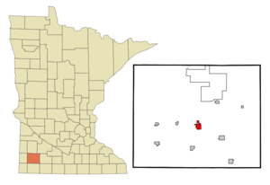
mapsize = 250px
map_caption = Location of Slayton, Minnesota
mapsize1 =
map_caption1 =subdivision_type = Country
subdivision_name =United States
subdivision_type1 = State
subdivision_name1 =Minnesota
subdivision_type2 = County
subdivision_name2 = Murraygovernment_footnotes =
government_type =
leader_title = Mayor
leader_name = Chuck Ludolph
leader_title1 =
leader_name1 =
established_title =
established_date =unit_pref = Imperial
area_footnotes =area_magnitude =
area_total_km2 = 4.6
area_land_km2 = 4.6
area_water_km2 = 0.0
area_total_sq_mi = 1.8
area_land_sq_mi = 1.8
area_water_sq_mi = 0.0population_as_of = 2000
population_footnotes =
population_total = 2072
population_density_km2 = 449.2
population_density_sq_mi = 1163.3timezone = Central (CST)
utc_offset = -6
timezone_DST = CDT
utc_offset_DST = -5
elevation_footnotes =
elevation_m = 488
elevation_ft = 1601
latd = 43 |latm = 59 |lats = 18 |latNS = N
longd = 95 |longm = 45 |longs = 21 |longEW = Wpostal_code_type =
ZIP code
postal_code = 56172
area_code = 507
blank_name = FIPS code
blank_info = 27-60808GR|2
blank1_name = GNIS feature ID
blank1_info = 0652147GR|3
website = [http://slayton.govoffice.com/ slayton.govoffice.com]
footnotes =Slayton is a city in and the
county seat of Murray County,Minnesota ,United States .GR|6 The population was 2,072 at the 2000 census.Geography
According to the
United States Census Bureau , the city has a total area of 1.8square mile s (4.6km² ), all of it land.U.S. Route 59 andMinnesota State Highway 30 are two of the main routes in the city.Demographics
As of the
census GR|2 of 2000, there were 2,072 people, 914 households, and 556 families residing in the city. Thepopulation density was 1,163.3 people per square mile (449.4/km²). There were 1,022 housing units at an average density of 573.8/sq mi (221.7/km²). The racial makeup of the city was 99.03% White, 0.14% African American, 0.05% Native American, 0.39% Asian, and 0.39% from two or more races. Hispanic or Latino of any race were 0.34% of the population.There were 914 households out of which 24.9% had children under the age of 18 living with them, 52.5% were married couples living together, 6.3% had a female householder with no husband present, and 39.1% were non-families. 35.7% of all households were made up of individuals and 23.6% had someone living alone who was 65 years of age or older. The average household size was 2.18 and the average family size was 2.81.
In the city the population was spread out with 22.2% under the age of 18, 6.2% from 18 to 24, 21.7% from 25 to 44, 20.6% from 45 to 64, and 29.2% who were 65 years of age or older. The median age was 45 years. For every 100 females there were 82.7 males. For every 100 females age 18 and over, there were 78.2 males.
The median income for a household in the city was $36,500, and the median income for a family was $43,935. Males had a median income of $30,444 versus $19,830 for females. The
per capita income for the city was $17,395. About 4.5% of families and 8.7% of the population were below thepoverty line , including 7.8% of those under age 18 and 13.1% of those age 65 or over.Education
Slayton is the home of Murray County Central School district. It is one of only two school districts left in the county (the other is Fulda Schools). The school has an average of 60 students a grade, below average even for the area. Lake Wilson schools closed before the turn of the century and joined with Slayton. Other towns in the area that have students attending MCC are: Currie, Chandler, Iona, Lake Wilson, Avoca, and more. Steve Jones is the superintendent and principal of the high school. Sally Berg is the principal of the elementary school.
References
External links
* [http://slayton.govoffice.com City website]
Wikimedia Foundation. 2010.