- Madison, Minnesota
Infobox Settlement
official_name = Madison, Minnesota
settlement_type =City
nickname =
motto =
imagesize =
image_caption =
image_
imagesize =
image_caption =
image_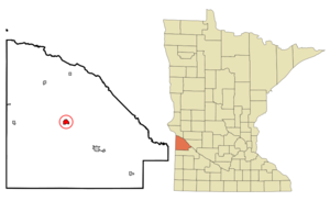
mapsize = 250px
map_caption = Location of Madison, Minnesota
mapsize1 =
map_caption1 =subdivision_type = Country
subdivision_name =United States
subdivision_type1 = State
subdivision_name1 =Minnesota
subdivision_type2 = County
subdivision_name2 = Lac qui Parlegovernment_footnotes =
government_type =
leader_title =
leader_name =
leader_title1 =
leader_name1 =
established_title =
established_date =unit_pref = Imperial
area_footnotes =area_magnitude =
area_total_km2 = 2.6
area_land_km2 = 2.6
area_water_km2 = 0.0
area_total_sq_mi = 1.0
area_land_sq_mi = 1.0
area_water_sq_mi = 0.0population_as_of = 2000
population_footnotes =
population_total = 1768
population_density_km2 = 670.9
population_density_sq_mi = 1737.6timezone = Central (CST)
utc_offset = -6
timezone_DST = CDT
utc_offset_DST = -5
elevation_footnotes =
elevation_m = 332
elevation_ft = 1089
latd = 45 |latm = 0 |lats = 49 |latNS = N
longd = 96 |longm = 11 |longs = 22 |longEW = Wpostal_code_type =
ZIP code
postal_code = 56256
area_code = 320
blank_name = FIPS code
blank_info = 27-39266GR|2
blank1_name = GNIS feature ID
blank1_info = 0647361GR|3
website = [http://www.ci.madison.mn.us/ www.ci.madison.mn.us]
footnotes =Madison is a city in Lac qui Parle County,
Minnesota ,United States . The population was 1,768 at the 2000 census. It is thecounty seat of Lac qui Parle CountyGR|6.Geography
According to the
United States Census Bureau , the city has a total area of 1.0square mile s (2.6km² ), all of it land.U.S. Route 75 andMinnesota State Highway 40 are two of the main routes in the city.Demographics
As of the
census GR|2 of 2000, there were 1,768 people, 789 households, and 462 families residing in the city. Thepopulation density was 1,737.6 people per square mile (669.2/km²). There were 882 housing units at an average density of 866.9/sq mi (333.9/km²). The racial makeup of the city was 99.21% White, 0.06% African American, 0.23% Asian, and 0.51% from two or more races. Hispanic or Latino of any race were 0.06% of the population.There were 789 households out of which 21.7% had children under the age of 18 living with them, 48.9% were married couples living together, 6.0% had a female householder with no husband present, and 41.4% were non-families. 39.0% of all households were made up of individuals and 28.0% had someone living alone who was 65 years of age or older. The average household size was 2.07 and the average family size was 2.75.
In the city the population was spread out with 19.1% under the age of 18, 5.1% from 18 to 24, 17.9% from 25 to 44, 22.1% from 45 to 64, and 35.9% who were 65 years of age or older. The median age was 51 years. For every 100 females there were 80.0 males. For every 100 females age 18 and over, there were 77.1 males.
The median income for a household in the city was $27,102, and the median income for a family was $38,008. Males had a median income of $27,903 versus $20,694 for females. The
per capita income for the city was $17,435. About 3.7% of families and 7.8% of the population were below thepoverty line , including 5.1% of those under age 18 and 11.7% of those age 65 or over.Movies filmed wholly or partially in Madison
*
Sweet Land (2005)References
External links
* [http://www.ci.madison.mn.us/ City of Madison, MN -- Official site]
* [http://www.madisonmn.info/ Madison, MN -- Business, Community, and Visitor Information site]
Wikimedia Foundation. 2010.