- Międzygórze, Lower Silesian Voivodeship
-
For other places with the same name, see Międzygórze (disambiguation).
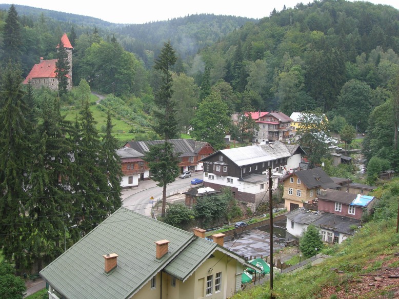
Międzygórze — Village — 

 Międzygórze
Coordinates: 50°13′41″N 16°46′0″E / 50.22806°N 16.766667°ECoordinates: 50°13′41″N 16°46′0″E / 50.22806°N 16.766667°E Country  Poland
Voivodeship Lower Silesian County Kłodzko Gmina Bystrzyca Kłodzka Elevation(max.) 680 m (2,231 ft) Population 700 Międzygórze [mjɛnd͡zɨˈɡuʐɛ] (German: Wölfelsgrund) is a village in the administrative district of Gmina Bystrzyca Kłodzka, within Kłodzko County, Lower Silesian Voivodeship, in south-western Poland.[1] Prior to 1945 it was in Germany.
It lies approximately 12 kilometres (7 mi) south-east of Bystrzyca Kłodzka, 25 kilometres (16 mi) south of Kłodzko, and 102 kilometres (63 mi) south of the regional capital Wrocław.
The village has a population of 700.
References
Town and seat 
Villages Długopole Dolne • Długopole-Zdrój • Gorzanów • Huta • Idzików • Kamienna • Lasówka • Marcinków • Marianówka • Międzygórze • Mielnik • Młoty • Mostowice • Nowa Bystrzyca • Nowa Łomnica • Nowy Waliszów • Paszków • Piotrowice • Pławnica • Pokrzywno • Poniatów • Ponikwa • Poręba • Rudawa • Spalona • Stara Bystrzyca • Stara Łomnica • Starkówek • Stary Waliszów • Szczawina • Szklarka • Szklary • Topolice • Wilkanów • Wójtowice • Wyszki • Zabłocie • ZalesieCategories:- Villages in Kłodzko County
- Kłodzko County geography stubs


Wikimedia Foundation. 2010.