- Lake Bronson, Minnesota
Infobox Settlement
official_name = Lake Bronson, Minnesota
settlement_type =City
nickname =
motto =
imagesize =
image_caption =
image_
imagesize =
image_caption =
image_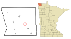
mapsize = 250px
map_caption = Location of Lake Bronson, Minnesota
mapsize1 =
map_caption1 =subdivision_type = Country
subdivision_name =United States
subdivision_type1 = State
subdivision_name1 =Minnesota
subdivision_type2 = County
subdivision_name2 = Kittsongovernment_footnotes =
government_type =
leader_title =
leader_name =
leader_title1 =
leader_name1 =
established_title =
established_date =unit_pref = Imperial
area_footnotes =area_magnitude =
area_total_km2 = 1.6
area_land_km2 = 1.6
area_water_km2 = 0.0
area_total_sq_mi = 0.6
area_land_sq_mi = 0.6
area_water_sq_mi = 0.0population_as_of = 2000
population_footnotes =
population_total = 246
population_density_km2 = 158.4
population_density_sq_mi = 410.3timezone = Central (CST)
utc_offset = -6
timezone_DST = CDT
utc_offset_DST = -5
elevation_footnotes =
elevation_m = 293
elevation_ft = 961
latd = 48 |latm = 43 |lats = 57 |latNS = N
longd = 96 |longm = 39 |longs = 46 |longEW = Wpostal_code_type =
ZIP code
postal_code = 56734
area_code = 218
blank_name = FIPS code
blank_info = 27-34136GR|2
blank1_name = GNIS feature ID
blank1_info = 0646332GR|3
website =
footnotes =Lake Bronson is a city in Kittson County,
Minnesota ,United States . The population was 246 at the 2000 census.Lake Bronson State Park is nearby. The current mayor is Cammie Taylor (reelected 2006).fact|date=May 2008Geography
According to the
United States Census Bureau , the city has a total area of 0.6square mile s (1.6km² ), all of it land.Demographics
As of the
census GR|2 of 2000, there were 246 people, 128 households, and 66 families residing in the city. Thepopulation density was 410.3 people per square mile (158.3/km²). There were 147 housing units at an average density of 245.2/sq mi (94.6/km²). The racial makeup of the city was 97.15% White, 2.44% African American, and 0.41% from two or more races.There were 128 households out of which 15.6% had children under the age of 18 living with them, 38.3% were married couples living together, 8.6% had a female householder with no husband present, and 48.4% were non-families. 42.2% of all households were made up of individuals and 23.4% had someone living alone who was 65 years of age or older. The average household size was 1.92 and the average family size was 2.59.
In the city the population was spread out with 16.7% under the age of 18, 4.1% from 18 to 24, 26.0% from 25 to 44, 27.6% from 45 to 64, and 25.6% who were 65 years of age or older. The median age was 48 years. For every 100 females there were 101.6 males. For every 100 females age 18 and over, there were 95.2 males.
The median income for a household in the city was $25,278, and the median income for a family was $30,938. Males had a median income of $29,107 versus $25,208 for females. The
per capita income for the city was $12,239. About 20.8% of families and 24.1% of the population were below thepoverty line , including 23.0% of those under the age of eighteen and 18.0% of those sixty five or over.References
Wikimedia Foundation. 2010.