- Crag Cave
-
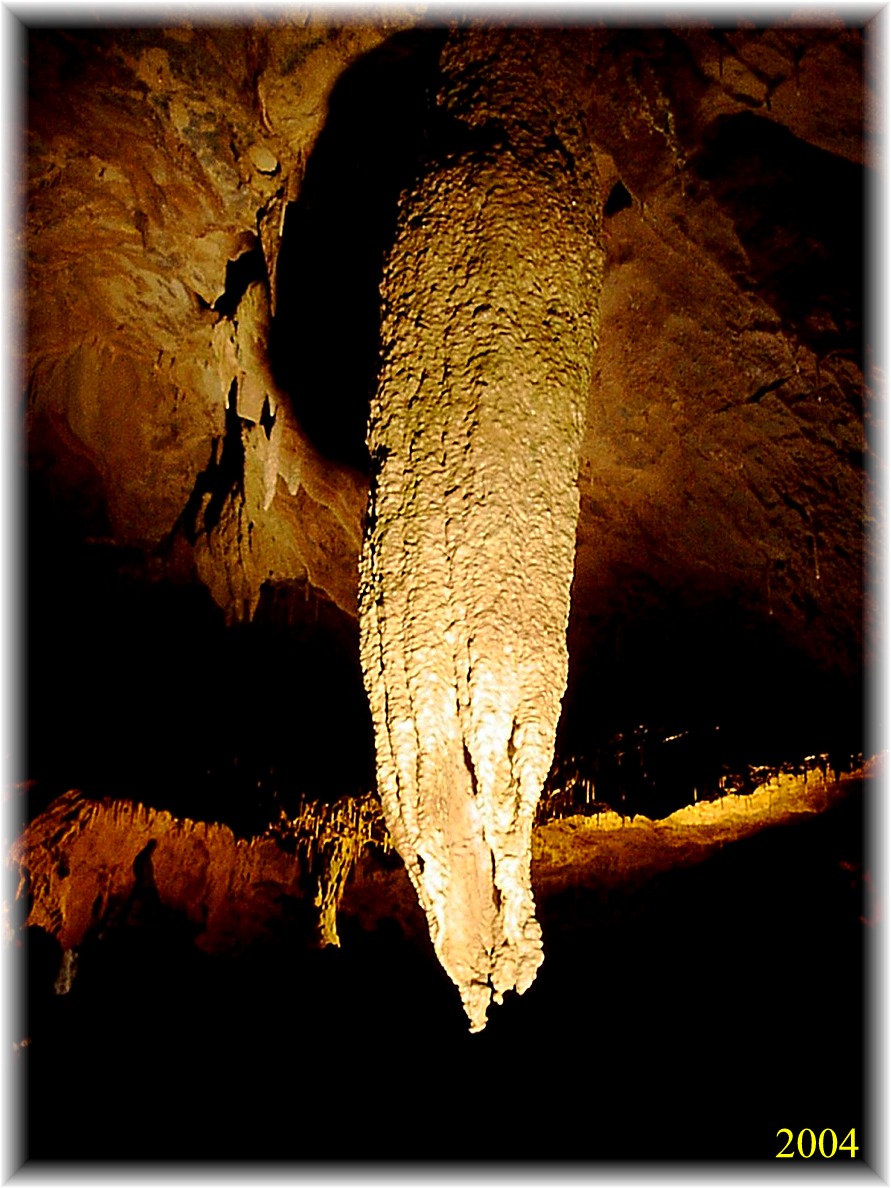
 The Big Stalactite in Crag Cave
Crag Cave is a cave in Ireland, located just outside Castleisland, County Kerry.
Formed in elevated limestone rock, the system extends to 3.8 kilometres (2.4 mi) of surveyed passage, on two levels.[1] It is the 7th-longest cave system in the Republic of Ireland, and the 10th-longest in the whole of Ireland.[2]
Crag Cave runs under Castleisland itself, starting at Glounsharoon and ending on the far side of town at the Killarney Road. As the cave entrance is located at a higher elevation than its surroundings, it offers a spectacular view of the McGillicuddy Reeks and Tralee Bay.
Contents
History of exploration
While the Geological Survey of Ireland in 1859 acknowledged the presence of "caves worn by water, some of which can be traversed for some distance,"[3] positive efforts at exploration were not made until 1981, when the upper part of the cave was explored to a sump, named the "Green Lake".[4] When hydrological testing of water both in the cave's active streamway and in the sump showed that the two were chemically distinct from each other, it was postulated that the sump was only "perched" above the water table and that further dry passage might be found on the far side.[4] The sump was dived by Martyn Farr in 1983, providing the first access to the large caverns beyond.[4] A boulder obstruction nearby was passed, allowing a dry connection into the new chambers. Following the breakthrough, 1.6 km (1 mi) of passage was explored and surveyed.[4][5]
Between 1981 and 1985, further exploration and surveying brought the total length of the cave to 3.81 km (2.37 mi),[1] with a vertical range of approximately 15 m (49 ft).[5]
Show cave
Around 350 metres (1,150 ft) of the Crag Cave system was developed as a show cave by local residents, Dr. Donal and Mrs Margaret Geaney, under whose land the cave was first discovered. The cave was developed between 1987 and 1989 by building a shaft (which is the only man-made entrance) and putting in pathways, railings, lights and a music system. It was opened to the public on 20th May 1989.[6]
The show cave attracts thousands of visitors every year. The tourists are given a guided tour of the cave which takes a half an hour. There are many beautiful chambers in the cave including the Cathedral and the aptly named Crystal Gallery.
A lot of features in the cave have been named after locations or characters from J.R.R. Tolkien's Middle-earth.
The tourist centre contains a gift-shop, coffee shop and a children's play area.
See also
References
- ^ a b Jones, Gareth Ll. (November 1995). "The Crag Cave and Associated Karst". Irish Speleology (Speleological Union of Ireland) 15: 20–21. ISSN 0332-4907.
- ^ "R. O. Ireland – Longest Caves". UK Caves. http://www.ukcaves.co.uk/country-roireland-longest. Retrieved 2010-12-13.
- ^ Geological Survey Memoir to Sheet 162 (19). Geological Survey of Ireland. 1859.
cited in Coleman, J. C. (1965). The Caves of Ireland. Tralee, Co. Kerry: Anvil Press. p. 24. "In this area, N E of Castleisland, the Geol. Survey Memoir to Sheet 162 (19) notes that the limestone forms craggy knolls “in which are caves worn by water, some of which are traversable for some distance.” The OS map shows a line of unnamed holes running north and south approximately east of Crag House." - ^ a b c d Gunn, John (November 1983). "Crag Cave – '83 Extension". Caves & Caving (British Cave Research Association) 22: 2–3. ISSN 0142-1832.
- ^ a b Burns, G., ed (1985). "Crag Cave". Irish Speleology (Speleological Union of Ireland) 3 (2): 42–46. ISSN 0332-4907.
- ^ "Tour of Crag Cave". Crag Cave official website. http://www.cragcave.com/artman2/publish/cavetour/. Retrieved 2009-05-01.
External links
Coordinates: 52°15′01″N 9°26′27″W / 52.250194°N 9.440736°W
Categories:- Landforms of County Kerry
- Limestone caves
- Show caves
- Caves of the Republic of Ireland
- Visitor attractions in County Kerry
- Protected areas of County Kerry
- Caving stubs
- County Kerry geography stubs
Wikimedia Foundation. 2010.