- Zeevang
Infobox Settlement
official_name = Zeevang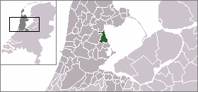
mapsize = 280px
flag_size = 150x75px
image_shield = Zeevang wapen.png
subdivision_type = Country
subdivision_name =Netherlands
subdivision_type1 = Province
subdivision_name1 =North Holland
leader_name = M.E. Smit
leader_party = PvdA
area_footnotes = (2006)
area_total_km2 = 55.23
area_land_km2 = 38.19
area_water_km2 = 17.04
population_as_of =1 January ,2007
population_note = Source: CBS, [http://statline.cbs.nl/ Statline] .
settlement_type = Municipality
population_total = 6325
population_density_km2 = 166
timezone = CET
utc_offset = +1
timezone_DST = CEST
utc_offset_DST = +2
latd = 52.57
latNS = N
longd = 5.00
longEW = E
website = [http://www.zeevang.nl www.zeevang.nl].
Population centres
The municipality of Zeevang consists of the following cities, towns, villages and/or districts: Beets,
Etersheim ,Hobrede ,Kwadijk ,Middelie ,Oosthuizen ,Schardam , Warder.Local government
The municipal council of Zeevang consists of 13 seats, which are divided as follows:
* Gemeente Belangen Zeevang (GBZ) - 5 seats
* VVD - 4 seats
* PvdA - 3 seats
* CDA - 1 seatReferences
* Statistics are taken from the [http://www.sdu.nl/staatscourant/gemeentes/gem554nh.htm SDU Staatscourant]

Wikimedia Foundation. 2010.