- Stede Broec
Infobox Settlement
official_name = Stede Broec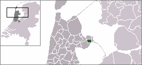
mapsize = 280px
flag_size = 150x75px
image_shield = Stede-Broec-wapen.png
subdivision_type = Country
subdivision_name =Netherlands
subdivision_type1 = Province
subdivision_name1 =North Holland
leader_name = H.A. Eggermont
leader_party = PvdA
area_footnotes = (2006)
area_total_km2 = 16.42
area_land_km2 = 14.77
area_water_km2 = 1.65
population_as_of =1 January ,2007
population_note = Source: CBS, [http://statline.cbs.nl/ Statline] .
settlement_type = Municipality
population_total = 21343
population_density_km2 = 1445
timezone = CET
utc_offset = +1
timezone_DST = CEST
utc_offset_DST = +2
latd = 52.70
latNS = N
longd = 5.25
longEW = E
website = [http://www.stedebroec.nl www.stedebroec.nl]).
Population centres
The municipality of Stede Broec consists of the following cities, towns, villages and/or districts:
Bovenkarspel ,Broekerhaven ,Grootebroek , Horn,Lutjebroek .History
Grootebroek and Bovenkarspel together received city rights in
1364 , under the name of Broek. In1402 Lutjebroek shared in the city rights and Hoogkarspel joined in1403 .Andijk was the fifth to join in1786 . In1825 the city was dissociated.Stede Broec is located in the region of West Friesland consisting of all the land surrounded by the West-Friese Omringdijk, a dike which then protected the land against the dangers of the tides of the
Zuider Zee .Local government
The municipal council of Stede Broec consists of 19 seats, which are divided as follows (as of 7 March 2006):
* CDA - 4 seats
* PvdA - 4 seat
* Open en Duidelijk Stede Broec - 4 seats
* Gemeentebelangen - 3 seats
* Onafhankelijke Partij - 2 seats
*GroenLinks - 1 seat
* VVD - 1 seatReferences
* Statistics are taken from the [http://www.sdu.nl/staatscourant/gemeentes/gem451nh.htm SDU Staatscourant]
Wikimedia Foundation. 2010.