- Marion Township, Jennings County, Indiana
-
Marion Township — Township — Location in Jennings County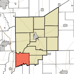
Coordinates: 38°51′09″N 85°44′58″W / 38.8525°N 85.74944°WCoordinates: 38°51′09″N 85°44′58″W / 38.8525°N 85.74944°W Country United States State Indiana County Jennings Government – Type Indiana township Area – Total 33.01 sq mi (85.51 km2) – Land 32.98 sq mi (85.41 km2) – Water 0.04 sq mi (0.09 km2) 0.11% Elevation 587 ft (179 m) Population (2000) – Total 1,058 – Density 32.1/sq mi (12.4/km2) GNIS feature ID 0453608 Marion Township is one of eleven townships in Jennings County, Indiana, USA. As of the 2000 census, its population was 1,058.[1]
Contents
Geography
Marion Township covers an area of 33.01 square miles (85.5 km2); of this, 0.04 square miles (0.10 km2) or 0.11 percent is water. The streams of Brushy Fork, Crooked Creek, Sixmile Creek and Slate Creek run through this township.
Adjacent townships
- Spencer Township (north)
- Lovett Township (northeast)
- Montgomery Township (east)
- Graham Township, Jefferson County (southeast)
- Jennings Township, Scott County (south)
- Johnson Township, Scott County (south)
- Vernon Township, Jackson County (southwest)
- Washington Township, Jackson County (west)
Cemeteries
The township contains two cemeteries: German and Keith.
Major highways
References
External links
Municipalities and communities of Jennings County, Indiana City 
Town Townships Bigger | Campbell | Center | Columbia | Geneva | Lovett | Marion | Montgomery | Sand Creek | Spencer | Vernon
Unincorporated
communitiesBrewersville | Butlerville | Commiskey | Four Corners | Grayford | Hayden | Hilltown | Lovett | Nebraska | Paris | Paris Crossing | Queensville | San Jacinto | Scipio | Walnut Ridge | Zenas
Categories:- Townships in Jennings County, Indiana

Wikimedia Foundation. 2010.