- Scarborough—Agincourt
Infobox Canada electoral district
province = Ontario
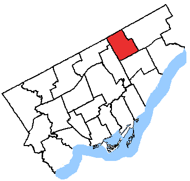
caption = Scarborough—Agincourt in relation to the other Toronto ridings
fed-status = active
fed-district-number = 35080
fed-created = 1987
fed-abolished =
fed-election-first = 1988
fed-election-last = 2006
fed-rep = Jim Karygiannis
fed-rep-link =
fed-rep-party = Liberal
fed-rep-party-link = Liberal Party of Canada
prov-status = active
prov-created = 1999
prov-abolished =
prov-election-first = 1999
prov-election-last = 2007
prov-rep = Gerry Phillips
prov-rep-link =
prov-rep-party = Liberal
prov-rep-party-link = Ontario Liberal Party
demo-census-date = 2006
demo-pop = 111867
demo-electors = 73876
demo-electors-date = 2007
demo-area = 25
demo-cd =Toronto
demo-csd = ScarboroughScarborough—Agincourt is a federal and provincial electoral district in
Ontario ,Canada that has been represented in theCanadian House of Commons since 1988, and in theLegislative Assembly of Ontario since 1999.It covers the northwest of the Scarborough part of
Toronto . It is bounded on the west byVictoria Park Avenue , on the north bySteeles Avenue East, on the east by Brimley Avenue, and on the south by Highway 401, excluding the area that is east of Midland Avenue and north ofFinch Avenue East.On
Toronto City Council , much of the northern half of the area is represented byMike Del Grande ; the south byNorm Kelly ; the east byChin Lee .Former boundaries
Demographics
Population
Total (2006): 111,867
Growth (2001-2006): +1,197 (+1.1%)
Electors:
:Federal (2006): 72,895 (65.2%)
:Provincial (2007): 73,876 (66%)
Gender* (2001):
:Male: 52,525 (47.5%)
:Female: 58,145 (52.5%)
Identifiable Groups** (2001):
:Visible Minority: 76,195 (69.3%)
::Chinese: 41,135 (37.4%)
::South Asian: 14,680 (13.3%)
::Black: 7,450 (6.8%)
::Filipino: 3,470 (3.2%)
::West Asian: 1,830 (1.7%)
::Arab: 1,775 (1.6%)
::Other Visible Minority: 1,560 (1.4%)
::Multiple Visible Minorities: 1,385 (1.3%)
::Latin American: 825 (0.8%)
::Southeast Asian: 800 (0.7%)
::Korean: 670 (0.6%)
::Japanese: 625 (0.6%)
::Aboriginal: 185 (0.2%)
:Immigrant: 70,315 (63.9%)
:Non-Permanent Residents: 1,780 (1.6%)Language
Mother Tongue** (2001):
:English: 39,880 (36.3%)
:French: 775 (0.7%)
:Non-Official Languages: 66,755 (60.7%)
:Multiple Responses: 2,590 (2.4%)Knowledge of Official Languages** (2001):
:English only: 92,290 (83.9%)
:Neither English nor French: 10,855 (9.9%)
:English and French: 6,755 (6.1%)
:French only: 105 (0.001%)Home Language** (2001):
:English: 42,110 (38.3%)
:Non-official languages: 34,760 (31.6%)
:English and non-official language: 31,875 (29%)
:English and French: 625 (0.6%)
:English, French and non-official language: 430 (0.4%)
:French: 110 (0.1%)
:French and non-official language: 85 (0.1%)Education
Education*** (2001):
:Less than High School: 29,385 (32.6%)
:High School: 22,950 (25%)
:Trade School: 5,205 (5.7%)
:College: 11,775 (12.8%)
:University: 22,530 (24.5%)Income and work
Labour Force*** (2001):
:Participation: 55,510 (60.4%)
:Employed: 50,840 (55.4%)
:Unemployed: 4,670 (8.4%)Average Income*** (2001):
:Individual: $26,473
:Household: $62,836
:Family: $60,742Median Income (2007):
:Household: $51,762Families and dwellings
Persons per Family (2001): 3.1
Occupied Private Dwellings (2001):
:Total: 35,615
:Owned: 23,670 (66.5%)
:Rented: 11,945 (33.5%)
:Average Value: $226,053Religion
Religion** (2001):
:Christian: 58,125 (52.8%)
::Catholic: 24,660 (22.4%)
::Protestant: 19,670 (17.9%)
::Christian Orthodox: 7,365 (6.7%)
::Christian n.i.e.****: 6,430 (5.8%)
:No Religious Affiliation: 31,220 (28.4%)
:Hindu: 7,300 (6.6%)
:Muslim: 6,740 (6.1%)
:Buddhist: 5,515 (5%)
:Eastern Religions: 380 (0.3%)
:Sikh: 360 (0.3%)
:Jewish: 330 (0.3%)
:Other Religions: 30 (0.03%)
* Based on a total population of 110,670
** Based on a projected population of 109,995 (20% sample data projected from the total population)
*** Based on a projected population of 91,840 (20% sample data projected from the population 15 years and over)
**** Includes mostly answers of 'Christian,' not otherwise stated."Sources: Statistics Canada (2001, 2006); Elections Canada (2006); Elections Ontario (2007)"
Federal electoral district
The federal riding was created in 1987 from
York—Scarborough . It consisted in initially of the part of the City of Scarborough bounded on the west by Victoria Park Avenue, on the north by Steeles Avenue East, on the east by theCanadian National Railway line situated immediately west of Midland Avenue, and on the south by Ellesmere Road.In 2003, it was given its current boundaries as described above.
Members of Parliament
This riding has elected the following members of the
Canadian House of Commons :OntElec5|1999
-Gerry Phillips
align="right"|18,698
align="right"|50.7
-
Jim Brown
align="right"|15,915
align="right"|43.15
-
Bob Frankford
align="right"|1,319
align="right"|3.58
-
Gary Carmichael
align="right"|451
align="right"|1.22
-
Wayne Cook
align="right"|371
align="right"|1.01
-
Ken Morgan
align="right"|129
align="right"|0.35Municipal electoral districts & neighbourhoods
Scarborough—Agincourt covers three wards and six neighbourhoods.
Wards
Three wards fall completely or partially within the borders of Scarborough—Agincourt.
* [http://www.toronto.ca/wards2000/ward39.htm Ward 39]
* [http://www.toronto.ca/wards2000/ward40.htm Ward 40] (North)
* [http://www.toronto.ca/wards2000/ward41.htm Ward 41] (West)Neighbourhoods
Three neighbourhoods fall completely within the borders of Scarborough—Agincourt:
* [http://www.toronto.ca/demographics/cns_profiles/cns116.htm #116] -
Steeles
* [http://www.toronto.ca/demographics/cns_profiles/cns117.htm #117] -L'Amoreaux
* [http://www.toronto.ca/demographics/cns_profiles/cns118.htm #118] -Tam O'Shanter-Sullivan The west ends of three neighbourhoods also fall within the borders of Scarborough—Agincourt:
* [http://www.toronto.ca/demographics/cns_profiles/cns128.htm #128] - Agincourt South-Malvern West
* [http://www.toronto.ca/demographics/cns_profiles/cns129.htm #129] - Agincourt North
* [http://www.toronto.ca/demographics/cns_profiles/cns130.htm #130] - MillikenCity Councillors
Ward 39
#
Sherene Shaw (1988-2003)
#Mike Del Grande (2003-present)Ward 40
#
Norm Kelly (1994-present)Ward 41
#
Bas Balkissoon (1997-2005)
#Paul Ainslie (appointed in 2006)
#Chin Lee (2006-present)See also
*
List of Canadian federal electoral districts
*Past Canadian electoral districts External links
* [http://www.parl.gc.ca/information/about/process/house/hfer/hfer.asp?Language=E&Search=Det&Include=Y&rid=961 Riding history] from
Library of Parliament
* Elections Ontario [http://www.electionsontario.on.ca/results/1999_results/stat_summary.jsp?e_code=37&rec=0&] and [http://www.electionsontario.on.ca/results/2003_results/stat_summary.jsp?e_code=38&rec=0&
]
Wikimedia Foundation. 2010.