- Scarborough Centre
Infobox Canada electoral district
province = Ontario
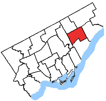
caption = Scarborough Centre in relation to the other Toronto ridings
fed-status = active
fed-district-number = 35081
fed-created = 1976
fed-abolished =
fed-election-first = 1979
fed-election-last = 2006
fed-rep = John Cannis
fed-rep-link =
fed-rep-party = Liberal
fed-rep-party-link = Liberal Party of Canada
prov-status = active
prov-created = 1999
prov-abolished =
prov-election-first = 1999
prov-election-last = 2007
prov-rep = Brad Duguid
prov-rep-link =
prov-rep-party = Liberal
prov-rep-party-link = Ontario Liberal Party
demo-census-date = 2006
demo-pop = 108010
demo-electors = 69582
demo-electors-date = 2007
demo-area = 29
demo-cd =Toronto
demo-csd = Scarborough:"This page covers the electoral district of Scarborough Centre; for the Scarborough RT station, see
Scarborough Centre (TTC) ."Scarborough Centre is a federal and provincial electoral district in
Ontario ,Canada , that has been represented in theCanadian House of Commons since 1979, and in theLegislative Assembly of Ontario since 1999.The riding was created in 1976 from parts of
Scarborough East ,Scarborough West ,Scarborough—Agincourt , andYork—Scarborough ridings.It consists of the part of the Scarborough district of the City of
Toronto bounded:
*on the west by Victoria Park Avenue,
*on the north by Highway 401,
*on the east by Toyota Place, Corporate Drive and Bellamy Road North, and
*on the south by Eglinton Avenue East, the Canadian National Railway and the hydroelectric transmission line situated north of Romulus Drive.Notable landmarks in Scarborough Centre include:
*Scarborough Civic Centre , site of eastToronto district council meetings, and adjacentAlbert Campbell Square
*Scarborough Town Centre , a large shopping mall
*Scarborough Centre (TTC) RT station
*Scarborough Hospital , General Division
* [http://www.toronto.ca/culture/scarborough_historical.htm Scarborough Historical Museum]It has been represented in the House of Commons by Liberal
John Cannis since 1993, and in the Ontario Legislature by LiberalBrad Duguid since 2003. OnToronto City Council , the eastern portion is represented byGlenn De Baeremaeker , and the western half by Michael Thompson.Federal electoral district
Scarborough Centre was created in 1976. It consisted initially of the part of the Borough of Scarborough bounded on the west by Victoria Park Avenue, on the north by Ellesmere Road, on the east by Bellamy Road North, and on the south by Eglinton Avenue East.
In 1987, it was expanded to include the part of Scarborough lying bounded by Bellamy Road North, Lawrence Avenue East, Markham Road and Eglinton Avenue East.
In 1996, it was redefined such that it was bounded:
* on the west by Victoria Park Avenue,
*on the north by a line drawn from west to east along Ellesmere Road, north along the Canadian National Railway and west along Highway 401,
* on the east by a line drawn from north to south along Highland Creek East, west along Ellesmere Road, south along Scarborough Golf Club Road, west along Lawrence Avenue East and south along Markham Road, and
*on the south by Eglinton Avenue East.In 2003, it was given its current boundaries as described above.
Members of Parliament
This riding has elected the following Members of Parliament:
OntElec5|1999
-Marilyn Mushinski
align="right"|18,189
align="right"|43.12
-Costas Manios
align="right"|14,565
align="right"|34.53
-Sid Ryan
align="right"|8,399
align="right"|19.91
-
Rina Morra
align="right"|573
align="right"|1.36
-
Eileen Murray
align="right"|455
align="right"|1.08See also
*
List of Canadian federal electoral districts
*Past Canadian electoral districts External links
* [http://www.parl.gc.ca/information/about/process/house/hfer/hfer.asp?Language=E&Search=Det&Include=Y&rid=672 Riding history from the]
Library of Parliament * Elections Ontario [http://www.electionsontario.on.ca/results/1999_results/stat_summary.jsp?e_code=37&rec=0&
] and [http://www.electionsontario.on.ca/results/2003_results/stat_summary.jsp?e_code=38&rec=0&
]
Wikimedia Foundation. 2010.