- Rhenen
Infobox Settlement
official_name = Rhenen
mapsize = 280px
subdivision_type = Country
subdivision_name =Netherlands
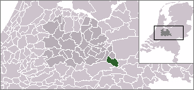
subdivision_type1 = Province
subdivision_name1 = Utrecht
area_footnotes = (2006)
area_total_km2 = 43.74
area_land_km2 = 42.07
area_water_km2 = 1.67
population_as_of =1 January ,2008
population_note = Source: CBS, [http://statline.cbs.nl/ Statline] .
settlement_type = Municipality
population_total = 18758
population_density_km2 = 444
timezone = CET
utc_offset = +1
timezone_DST = CEST
utc_offset_DST = +2
latd = 51
latm = 58
latNS = N
longd = 5
longm = 34
longEW = ERhenen is a
municipality and acity in the centralNetherlands .The municipality also includes the villages ofAchterberg ,Remmerden , Elst ansLaareind . The town lies at a geographically interesting location, namely on the southernmost partof the chain of hills known as theUtrechtse Heuvelrug , where this meets the riverRhine . Because of this Rhenen has a unique character with pretty much elevation through town.Directly to the east of the built-up area lies the Grebbeberg,a hill the top of which lies at about 50 m.History
Before 1900
Rhenen received city rights probably between 1256 and 1258 [Kolman C., "et al." (1996). "Monumenten in Nederland: Utrecht". Zwolle: Waanders Uitgevers. ISBN 90-400-9757-7.] [Ph. J. van Dael, 'Over het Rhenense stadsrecht en het Rhenense (burger)zegel', in Oud Rhenen, 2002 no. 2, p. 5-38.] . In 1346, the bishop of Utrecht ordered the construction of a defensive wall around the city,which was important because it lay near the border with what is now the province of
Gelderland . Although for some time the town collected toll from ships on the Rhine, it has never hada harbour. The three city gates were demolished in 1840. Small fragments of the wall remain.The town is also famous for the Cunera Church, parts of which date back to the 15th century. Containingthe relics of Saint Cunera, it attracted many pilgrims. Legend has it that Cunera was buriedon a nearby hill now called the Cuneraheuvel. The church's tower was built between 1492and 1531.
In 1621, a palace was constructed at Rhenen for the ousted Frederick V. It was demolished in 1812.
World War II
Part of the center of Rhenen, which was located near the defensive Grebbelinie (
Grebbe line ), wasdestroyed during the German attack on the Netherlands in May1940 . Part of the reconstructiontook place during the war. In 1945, the town was damaged again.Many or all of the Dutch soldiers who were killed by the Germans near Rhenen lie buried at theErebegraafplaats (Honorary Cemetery), located along the Grebbeweg (N 225) near the topof the Grebbeberg. Across the road is an important war monument with a poem by
J.C. Bloem .Later years
In
2008 Rhenen celebrated its 750thanniversary Miscellaneous information
The town is also widely known for its zoo ( [http://www.ouwehand.nl Ouwehands Dierenpark] ).
References
External links
* [http://www.rhenen.nl Official Website]
* [http://www.plattegronden.nl/gemeenterhenen/ Map]
* [http://www.ouwehand.nl Ouwehands Dierenpark] (Zoo)
* [http://www.ogs.nl/reroute.asp?query=http://www.ogs.nl/pages/text.asp?Subject_ID=87 Oorlogsgraven Stichting] (War Cemetery Foundation)Province Utrecht

Wikimedia Foundation. 2010.