- Cobourg Peninsula
-
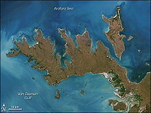 Image of Cobourg Peninsula
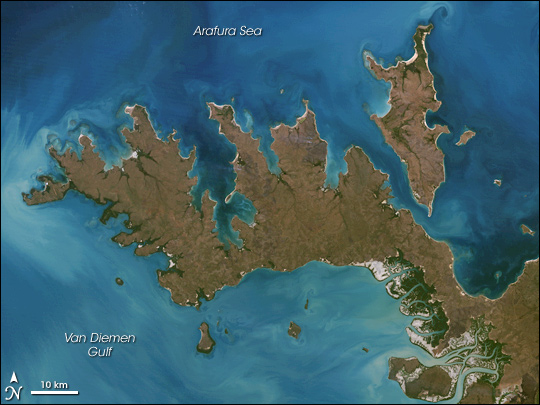
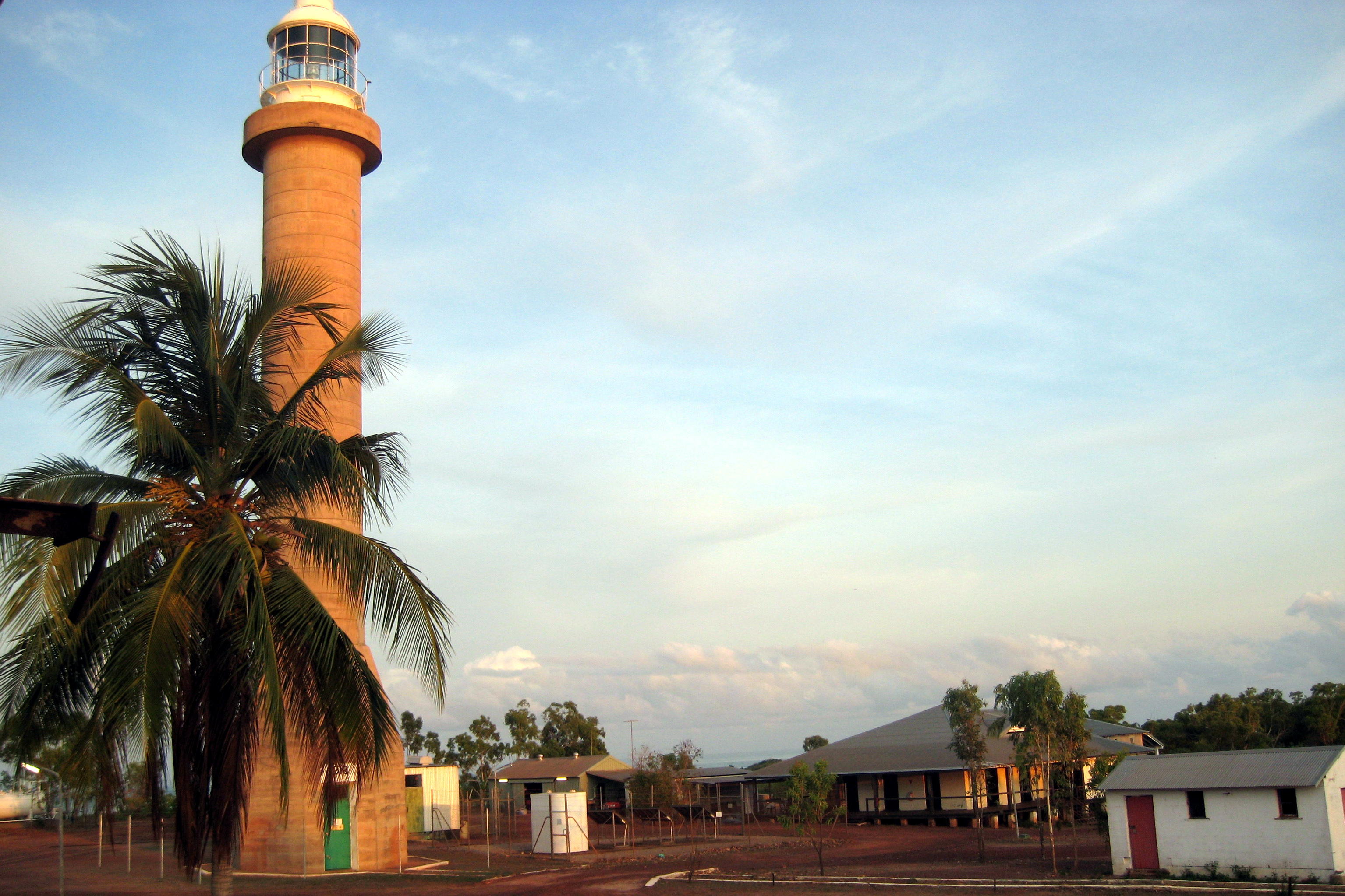
with Croker Island top right Cape Don Light at the western end of Cobourg Peninsula
The Cobourg Peninsula is located 350 kilometres east of Darwin in the Northern Territory, Australia. It is deeply indented with coves and bays, covers a land area of about 2,100 km², and is virtually uninhabited with a population ranging from about 20 to 30 in five family outstations, but without any notable settlement or village. It is separated from Croker Island in the east by Bowen Strait, which is 2.5 km wide in the south and up to 7 km in the north, and 8.5 km long. In the west, it is separated from Melville Island by Dundas Strait. From Cape Don, the western point of the peninsula, to Soldier Point in the east of Melville Island, the distance is 28 km. In the north is the Arafura Sea, and in the south the Van Diemen Gulf. The highest elevation is Mount Roe in the south with 160 metres.
All of Cobourg Peninsula is part of Garig Gunak Barlu National Park, which also encompasses a few nearshore islands. Mostly a tourist attraction, it is known for its pristine wilderness. It is home to a large variety of sea life and the world's largest herd of pure-strain banteng. It is also renowned for its Aboriginal culture. While it is only sparsely inhabited today, it was once the site of an attempt at founding a major trading port on its northern shores, Port Essington, of which the ruins are still accessible today.
There are no notable settlements or villages on Cobourg Peninsula, just a few family outstations and other establishments along or close to the north coast, from west to east [1][2]:
- Cape Don Light (lighthouse)
- Cape Don Airport (ICAO Code YCPD) (grass airfield 1800 m, opened 8 Nov 1989)
- Araru Point (Araru) (family outstation)
- Ardbinae (Adbanae, Trepang Bay) (family outstation)
- Port Essington (Victoria Settlement) (former European settlement)
- Gumuragi (Gumeragi, Reef Point) (family outstation)
- Algarlalgari (Black Point) (ranger station)
- Ngardimardi (Smith Point) (camping area)
- Gul Gul (Danger Point) (abandoned family outstation, ruins)
- Meriah (Mariah, Raffles Bay) (family outstation)
- Irgul (Irgul Point) (family outstation)
The closest village is Minjilang on Croker Island close east.
References
See also
Coordinates: 11°22′S 132°18′E / 11.367°S 132.3°E
Categories:- Geography of the Northern Territory
- Peninsulas of Australia
- Ramsar sites in Australia
- Northern Territory geography stubs
Wikimedia Foundation. 2010.