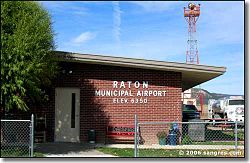
- Raton Municipal Airport
-
Raton Municipal Airport/Crews Field 
IATA: RTN – ICAO: KRTN Summary Airport type Public Operator City of Raton Serves Colfax County, New Mexico Location Raton, New Mexico Elevation AMSL 6,352 ft / 1,936 m Coordinates 36°44′30.85″N 104°30′11.05″W / 36.7419028°N 104.5030694°WCoordinates: 36°44′30.85″N 104°30′11.05″W / 36.7419028°N 104.5030694°W Runways Direction Length Surface ft m 2/20 6,328 1,928 Asphalt 7/25 4,404 1,342 Asphalt Raton Municipal Airport/Crews Field (IATA: RTN, ICAO: KRTN) is a general aviation airport located 10 miles (16 km) southwest of Raton, New Mexico, USA.
Facilities
Raton Municipal Airport/Crews Field covers 1,208 acres (489 ha) and has two runways:
- Runway 2/20: 6,328 x 75 ft (23 m). Surface: Asphalt
- Runway 7/25: 4,404 x 75 ft (23 m). Surface: Asphalt
External links
- Resources for this airport:
- AirNav airport information for KRTN
- ASN accident history for RTN
- FlightAware airport information and live flight tracker
- NOAA/NWS latest weather observations
- SkyVector aeronautical chart, Terminal Procedures for KRTN
- FAA Master Record for RTN
Categories:- Airports in New Mexico
- Buildings and structures in Colfax County, New Mexico
- Transportation in Colfax County, New Mexico
- Western United States building and structure stubs
- New Mexico stubs
- Western United States airport stubs
Wikimedia Foundation. 2010.
