- Waldo, Maine
Infobox Settlement
official_name = Waldo, Maine
settlement_type = Town
nickname =
motto =
imagesize =
image_caption =
image_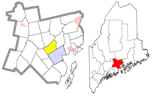
mapsize = 250px
map_caption = Location of Waldo (in yellow) in Waldo County and the state of Maine
mapsize1 =
map_caption1 =subdivision_type = Country
subdivision_name =United States
subdivision_type1 = State
subdivision_name1 =Maine
subdivision_type2 = County
subdivision_name2 = Waldo
government_footnotes =
government_type =
leader_title =
leader_name =
leader_title1 =
leader_name1 =
established_title =
established_date =unit_pref = Imperial
area_footnotes =area_magnitude =
area_total_km2 = 50.3
area_land_km2 = 50.3
area_water_km2 = 0.0
area_total_sq_mi = 19.4
area_land_sq_mi = 19.4
area_water_sq_mi = 0.0population_as_of = 2000
population_footnotes =
population_total = 733
population_density_km2 = 14.6
population_density_sq_mi = 37.8timezone = Eastern (EST)
utc_offset = -5
timezone_DST = EDT
utc_offset_DST = -4
elevation_footnotes =
elevation_m = 69
elevation_ft = 226
latd = 44 |latm = 27 |lats = 47 |latNS = N
longd = 69 |longm = 5 |longs = 37 |longEW = Wpostal_code_type =
ZIP code
postal_code = 04915
area_code = 207
blank_name = FIPS code
blank_info = 23-79480
blank1_name = GNIS feature ID
blank1_info = 0582785
website =
footnotes =Waldo is a town in Waldo County,
Maine ,United States . The population was 733 at the 2000 census.Geography
According to the
United States Census Bureau , the town has a total area of 19.4square mile s (50.3km² ), of which, 19.4 square miles (50.3 km²) of it is land and 0.05% is water.Demographics
As of the
census GR|2 of 2000, there were 733 people, 290 households, and 207 families residing in the town. Thepopulation density was 37.8 people per square mile (14.6/km²). There were 313 housing units at an average density of 16.1/sq mi (6.2/km²). The racial makeup of the town was 96.59% White, 0.55% African American, 0.95% Native American, 0.27% Asian, and 1.64% from two or more races. Hispanic or Latino of any race were 1.09% of the population.There were 290 households out of which 34.8% had children under the age of 18 living with them, 57.2% were married couples living together, 9.7% had a female householder with no husband present, and 28.6% were non-families. 21.7% of all households were made up of individuals and 5.2% had someone living alone who was 65 years of age or older. The average household size was 2.53 and the average family size was 2.96.
In the town the population was spread out with 26.3% under the age of 18, 6.7% from 18 to 24, 29.9% from 25 to 44, 26.9% from 45 to 64, and 10.2% who were 65 years of age or older. The median age was 38 years. For every 100 females there were 104.7 males. For every 100 females age 18 and over, there were 106.1 males.
The median income for a household in the town was $29,063, and the median income for a family was $38,125. Males had a median income of $25,341 versus $21,771 for females. The
per capita income for the town was $14,030. About 12.4% of families and 16.8% of the population were below thepoverty line , including 17.2% of those under age 18 and 18.4% of those age 65 or over.History
Waldo was named for the nearby
Mount Waldo , which in turn was named for Brigadier General Samuel Waldo of Boston, the proprietor of the area. [ [http://www.rays-place.com/history/me/waldo-cty-me.htm History of Waldo County, Maine ] ]References
Wikimedia Foundation. 2010.