- Castlewarden, County Kildare
Infobox Irish Place
name = Castlewarden
gaeilge =
crest
motto =
map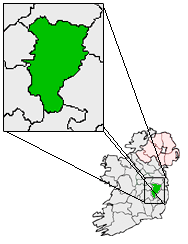
pin coords = left: 70px; top: 30px
north coord = 53.3 | west coord = 6.6 | irish grid =
area = | elevation = 70 m
province =Leinster
county =County Kildare
population =
census yr =
web = |Castlewarden is a
townland , monastic site and former parish situated betweenArdclough andKill, County Kildare just off the N7 inIreland . The district is home to a golf club and a riding school today.Etymology and History
After the Anglo-Norman invasion some time before 1173, Leinster was inherited by Strongbow Richard Fitz Gilbert de Clare "Strongbow", 2nd Earl of Pembroke, through his marriage to
Aoife of Leinster , daughter ofDiarmait MacMurrough , one of theKings of Leinster . The name Castlewarden appears to be derived from Warinus, Abbott of St Thomas’ Abbey in 1268 - Castellum Warin (Latin). Adam de Hereford had bestowed the lands on the Abbey of St Thomas, along with Wochtred (Oughter Ard ) after being given large territories of land by Strongow. The church was vacated by the early 1600s. The castle remained in good repair until the 1700s.Medieval Landmarks
Castlewarden House, which now forms the main building of Castlewarden Golf Club [http://www.CastlewardenGolfClub.com] , its medieval earthwork complex a motte and bailey and a rectangular enclosure are all listed monuments under the Kildare development plan. The earliest evidence of human habitation in the area was the discovery of a flint dated to 4800-3600BC, at
Castlewarden belowOughter Ard Hill, a rare find on a dryland location. Castlewarden hill is an ancient site associated with the 10 Uí Dúnchadakings of Leinster between 750 and 1050, whose inauguration took place on nearbyLyons Hill .Calendar and Civil Paper References
Stephen Creman was Vicar of Uachtar Árd and Castlewarden in 1541, where the church chancel was said to be “in need of repair.”The church had disappeared by the early 1600s although the site and that of a holy well can still be identified. The Castle was burned by order of LJs William Parsons and John Borlase in 1641.
Bibliography
*Ardclough Churches 1985 Souvenir Brochure.
*Corry, Eoghan and Tancred, Jim: Annals of Ardclough (Ardclough GAA 2004).
*Journals of the Kildare Archaeological Society: Volume I : 197. Volume IV : 255. Volume VI : 448. Volume XII : 340.
*Margaret Gowen & Co Ltd (Jackie Jordan), Architectural Assessment of Castlewarden Golf Club, 2002External links
* http://castlewardengolfclub.com
Wikimedia Foundation. 2010.