- North Vacherie, Louisiana
-
North Vacherie Census-designated place Country United States State Louisiana Parish St. James Elevation 7 ft (2.1 m) Coordinates 29°56′36″N 90°42′51″W / 29.94333°N 90.71417°W Area 11.6 sq mi (30 km2) - land 11.0 sq mi (28 km2) - water 0.6 sq mi (2 km2), 5.17% Population 2,411 (2000) Density 219.1 / sq mi (84.6 / km2) Timezone CST (UTC-6) - summer (DST) CDT (UTC-5) Area code 225 
 Location of North Vacherie in Louisiana
 Location of Louisiana in the United States
North Vacherie is a census-designated place (CDP) in St. James Parish, Louisiana, United States. The population was 2,411 at the 2000 census. Vacherie was noted in the 2000 as being the town with the least mobility of all the United States.[1]
Contents
Geography
North Vacherie is located at 29°59′36″N 90°42′51″W / 29.99333°N 90.71417°W (29.993379, -90.714089)[2].
According to the United States Census Bureau, the CDP has a total area of 11.6 square miles (30.1 km²), of which, 11.0 square miles (28.5 km²) of it is land and 0.6 square miles (1.6 km²) of it (5.25%) is water.
North Vacherie is known more popularly amongst locals as "Front Vacherie." Officially, both North Vacherie and South Vacherie are known overall as "Vacherie." South Vacherie is locally known as "Back Vacherie." The "unofficial" divider is Louisiana Highway 3127 which runs through the town from east to west. Other dividers that are commonly accepted for the dividing line of Front Vacherie and Back Vacherie are 1) an imaginary line drawn east to west just past the local watering hole "Daiquiri Explosion" and 2) St Patrick's St which runs east to west approx. 1 1/8 miles south of LA Hwy. 3127.
Demographics
As of the census[3] of 2000, there were 2,411 people, 763 households, and 618 families residing in the CDP. The population density was 219.1 people per square mile (84.5/km²). There were 829 housing units at an average density of 75.3 per square mile (29.1/km²). The racial makeup of the CDP was 24.55% White, 75.36% African American and Franco-African, 0.04% from other races, and 0.04% from two or more races. Hispanic or Latino of any race were 0.62% of the population.
There were 763 households out of which 41.4% had children under the age of 18 living with them, 50.7% were married couples living together, 26.7% had a female householder with no husband present, and 19.0% were non-families. 16.9% of all households were made up of individuals and 7.2% had someone living alone who was 65 years of age or older. The average household size was 3.16 and the average family size was 3.57.
In the CDP the population was spread out with 31.0% under the age of 18, 10.7% from 18 to 24, 26.5% from 25 to 44, 21.4% from 45 to 64, and 10.5% who were 65 years of age or older. The median age was 33 years. For every 100 females there were 89.5 males. For every 100 females age 18 and over, there were 84.6 males.
The median income for a household in the CDP was $31,154, and the median income for a family was $32,404. Males had a median income of $37,700 versus $20,000 for females. The per capita income for the CDP was $13,032. About 20.7% of families and 21.9% of the population were below the poverty line, including 32.8% of those under age 18 and 9.4% of those age 65 or over.
References
- ^ "The New York Times: Born on the Bayou And Barely Feeling Any Urge to Roam: Blaine Harden". September 22 2002. http://www.nytimes.com/2002/09/30/national/30ROOT.html. Retrieved 2006-08-23.
- ^ "US Gazetteer files: 2010, 2000, and 1990". United States Census Bureau. 2011-02-12. http://www.census.gov/geo/www/gazetteer/gazette.html. Retrieved 2011-04-23.
- ^ "American FactFinder". United States Census Bureau. http://factfinder.census.gov. Retrieved 2008-01-31.
External links
Municipalities and communities of St. James Parish, Louisiana Towns 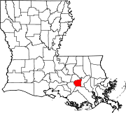
CDPs North Vacherie | South Vacherie
Unincorporated
communitiesCategories:- Census-designated places in Louisiana
- Populated places in St. James Parish, Louisiana
- Populated places in Louisiana with African American majority populations


Wikimedia Foundation. 2010.