- Mound, Louisiana
-
Village of Mound Village Country United States State Louisiana Parish Madison Elevation 89 ft (27.1 m) Coordinates 32°20′15″N 91°01′32″W / 32.3375°N 91.02556°W Area 0.2 sq mi (0.5 km2) - land 0.2 sq mi (1 km2) - water 0.0 sq mi (0 km2), 0% Population 12 (2000) Density 49.3 / sq mi (19 / km2) Timezone CST (UTC-6) - summer (DST) CDT (UTC-5) Area code 318 
 Location of Mound in Louisiana
 Location of Louisiana in the United States
Mound is a village in Madison Parish, Louisiana, United States. The population was 12 at the 2000 census. Its ZIP Code is 71282.
Mound is part of the Tallulah Micropolitan Statistical Area.
Geography
Mound is located at 32°20′15″N 91°1′32″W / 32.3375°N 91.02556°W (32.337430, -91.025694)[1].
According to the United States Census Bureau, the village has a total area of 0.2 square miles (0.52 km2), all land.
Demographics
As of the census[2] of 2000, there were 12 people, 4 households, and 4 families residing in the village. The population density was 49.3 inhabitants per square mile (19.3/km²). There were 5 housing units at an average density of 20.5 per square mile (8.0/km²). The racial makeup of the village was 100.00% White.
50.0% have children under the age of 18 living with them, 100.0% were married couples living together, and 0.0% were non-families. No households were made up of individuals and none had someone living alone who was 65 years of age or older. The average household size was 3.00 and the average family size was 3.00.
In the village the population was spread out with 25.0% under the age of 18, 8.3% from 18 to 24, 25.0% from 25 to 44, 25.0% from 45 to 64, and 16.7% who were 65 years of age or older. The median age was 42 years. For every 100 females there were 50.0 males. For every 100 females age 18 and over, there were 80.0 males.
The median income for a household in the village was in excess of $200,000, as is the median income for a family. Males and females have a median income over $100,000. The per capita income for the village was $92,200. There are 33.3% of families living below the poverty line and 50.0% of the population, including 50.0% of under eighteens and none of those over 64
References
- ^ "US Gazetteer files: 2010, 2000, and 1990". United States Census Bureau. 2011-02-12. http://www.census.gov/geo/www/gazetteer/gazette.html. Retrieved 2011-04-23.
- ^ "American FactFinder". United States Census Bureau. http://factfinder.census.gov. Retrieved 2008-01-31.
Municipalities and communities of Madison Parish, Louisiana Cities 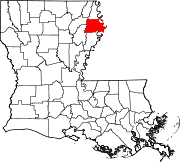
Villages Unincorporated
communityWaverly
Categories:- Populated places in Madison Parish, Louisiana
- Villages in Louisiana


Wikimedia Foundation. 2010.