- Athelstan, Iowa
Infobox Settlement
official_name = Athelstan, Iowa
settlement_type =City
nickname =
motto =
imagesize =
image_caption =
image_
imagesize =
image_caption =
image_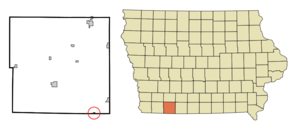
mapsize = 250x200px
map_caption = Location of Athelstan, Iowa
mapsize1 =
map_caption1 =subdivision_type = Country
subdivision_name =
subdivision_type1 = State
subdivision_name1 =
subdivision_type2 = County
subdivision_name2 = Taylor
government_footnotes =
government_type =
leader_title =
leader_name =
leader_title1 =
leader_name1 =
established_title =
established_date =unit_pref = Imperial
area_footnotes =area_magnitude =
area_total_km2 = 0.3
area_land_km2 = 0.3
area_water_km2 = 0.0
area_total_sq_mi = 0.1
area_land_sq_mi = 0.1
area_water_sq_mi = 0.0population_as_of = 2000
population_footnotes =
population_total = 18
population_density_km2 = 53.6
population_density_sq_mi = 138.8timezone = Central (CST)
utc_offset = -6
timezone_DST = CDT
utc_offset_DST = -5
elevation_footnotes =
elevation_m = 328
elevation_ft = 1076
latd = 40 |latm = 34 |lats = 22 |latNS = N
longd = 94 |longm = 32 |longs = 33 |longEW = Wpostal_code_type =
postal_code =
area_code =
blank_name = FIPS code
blank_info = 19-03430
blank1_name = GNIS feature ID
blank1_info = 0454272
website =
footnotes =Athelstan is a former city in Taylor County,
Iowa ,United States , along the Platte River, and is also majority owned by one family. The population was 18 at the 2000 census. In 2004, after years ofrural flight , the tiny city was disincorporated, ending its status as an officially recognized community.cite web| last =| first =| authorlink =| coauthors =| title =New, Consolidated and Discontinued Cities| work =State Data Center of Iowa| publisher =Iowa Data Center| date =2007-06-27| url =http://www.iowadatacenter.org/aboutdata/citydevelopmentboard/| format =| doi =| accessdate =2007-09-15]Geography
Athelstan is located at coor dms|40|34|22|N|94|32|33|W|city (40.572664, -94.542476)GR|1.
According to the
United States Census Bureau , the city had a total area of 0.1 square miles (0.3 km²), all land.Demographics
As of the
census GR|2 of 2000, there were 18 people, 13 households, and 2 families residing in the city. Thepopulation density was 138.8 people per square mile (53.5/km²). There were 16 housing units at an average density of 123.4/sq mi (47.5/km²). The racial makeup of the city was 100.00% White.There were 13 households out of which none had children under the age of 18 living with them, 15.4% were married couples living together, and 84.6% were non-families. 61.5% of all households were made up of individuals and 23.1% had someone living alone who was 65 years of age or older. The average household size was 1.38 and the average family size was 2.00.
In the city the population was spread out with 5.6% from 18 to 24, 22.2% from 25 to 44, 16.7% from 45 to 64, and 55.6% who were 65 years of age or older. The median age was 68 years. For every 100 females there were 200.0 males. For every 100 females age 18 and over, there were 200.0 males.
The median income for a household in the city was $23,750, and the median income for a family was $25,625. Males had a median income of $24,688 versus $0 for females. The
per capita income for the city was $13,737. There were no families and 31.6% of the population living below thepoverty line , including no under eighteens and 50.0% of those over 64.ee also
Other discontinued cities in Iowa:
* Donnan
* Green Island
* Hurstville
* Kent
* Littleport
* Moneta
* Oneida
* Plain ViewReferences
External links
Wikimedia Foundation. 2010.