Chaffey Dam

Chaffey Dam
Chaffey Dam
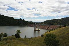
Location New South Wales
Coordinates 31°22′S 151°08′E / 31.36°S 151.13°E / -31.36; 151.13Coordinates: 31°22′S 151°08′E / 31.36°S 151.13°E / -31.36; 151.13
Lake type Reservoir
Primary inflows Peel River
Primary outflows Peel River
Basin countries Australia
Surface area 600ha
Max. depth 30m
Water volume 62 000 megalitres
Islands 1

Chaffey Dam is a dam 16 kilometres north of Nundle and 44 kilometres south of Tamworth in New South Wales. Its main purposes are regulating the flow of the Peel River and to augment the water supply of Tamworth.[1]

The dam has a capacity of 62,000 megalitres and a catchment area of 42,000 hectares. Its main wall is 54 metres high.[1]

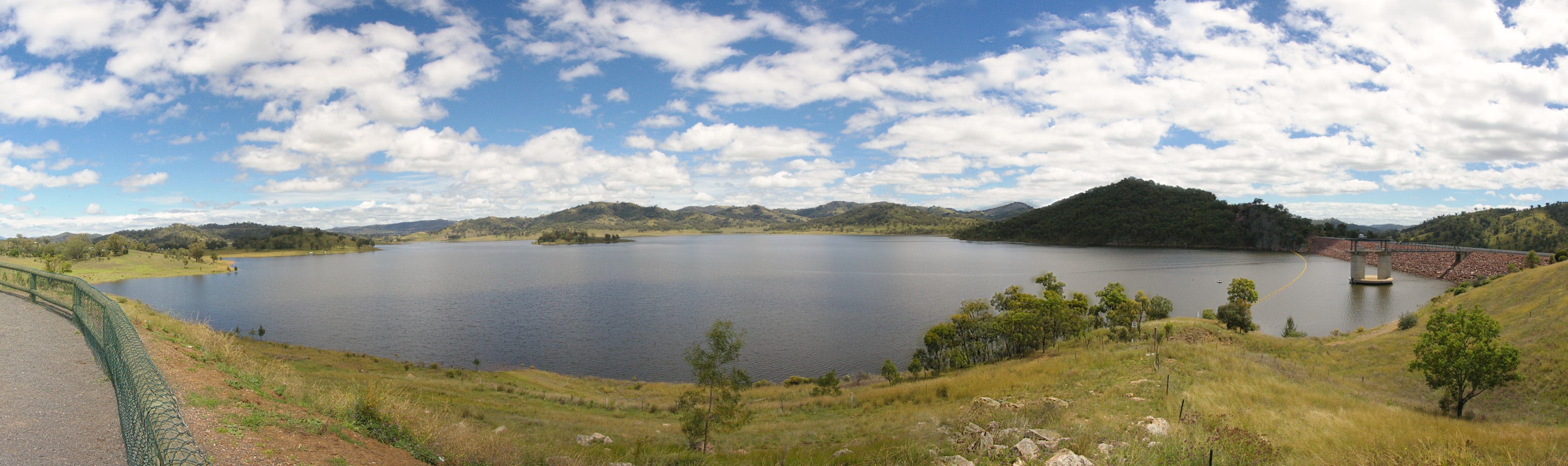
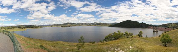
Chaffey Dam as viewed from lookout on Nundle Road

References


Wikimedia Foundation. 2010.

Игры ⚽ Нужен реферат?

Look at other dictionaries:

  • Chaffey — may refer to: Education Chaffey College in California Chaffey High School in California Chaffey Joint Union High School District in California Chaffey Adult School in California People George Chaffey (1848–1932), Canadian engineer, developer in… …   Wikipedia

  • List of dams and reservoirs in Australia — Dams and reservoirs in Australia is a link page for any dam or reservoir in Australia. Contents 1 Australian Capital Territory 2 New South Wales 2.1 Cancelled 2.2 Weir …   Wikipedia

  • Spillway — Chute spillway of Llyn Brianne dam in Wales A spillway is a structure used to provide the controlled release of flows from a dam or levee into a downstream area, typically being the river that was dammed. In the UK they may be known as overflow… …   Wikipedia

  • Nundle, New South Wales — Nundle New South Wales Nundle valley from the Hanging Rock lookout …   Wikipedia

  • New England (New South Wales) — New England New South Wales Mount Duval in New England Population …   Wikipedia

  • New England (Australia) — Infobox Australian Place | type = region name = New England state = nsw caption = Mt Duval in the New England lga = pop = 175,883 cite web url = http://www.business.nsw.gov.au/region/profiles/newengland northwest.htm title = Department of State… …   Wikipedia

  • Peel River (New South Wales) — For the Canadian River in the Yukon and Northwest Territories, see Peel River (Canada) Infobox River river name = Peel River image size = caption = origin = Liverpool Range mouth = confluence with the Namoi River basin countries = Australia… …   Wikipedia

  • Tamworth, New South Wales — Infobox Australian Place | type = city name = Tamworth state = nsw caption = Aerial view of Tamworth lga = Tamworth Regional Council county = Inglis postcode = 2340 pop = 42,499 (2006) poprank = 34th est = 1818 (explored) 1850 (established) 1946… …   Wikipedia

  • Global Lake Ecological Observatory Network — (GLEON) is an international grass roots, voluntary network of researchers, educators, and community groups interested in making and utilizing time series of high frequency observations made on and in lakes and reservoirs all over the world.… …   Wikipedia

  • Woolomin, New South Wales — Woolomin is a locality in New South Wales, Australia.Woolomin is a small settlement on the bank of the Peel River, about 20 km north of Nundle, New South Wales, and about 40 km south east of the city of Tamworth.It is not far from Chaffey… …   Wikipedia

Share the article and excerpts

Direct link
Do a right-click on the link above
and select “Copy Link”