- Clare Island
-
Clare Native name: Oileán Chliara 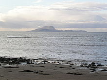
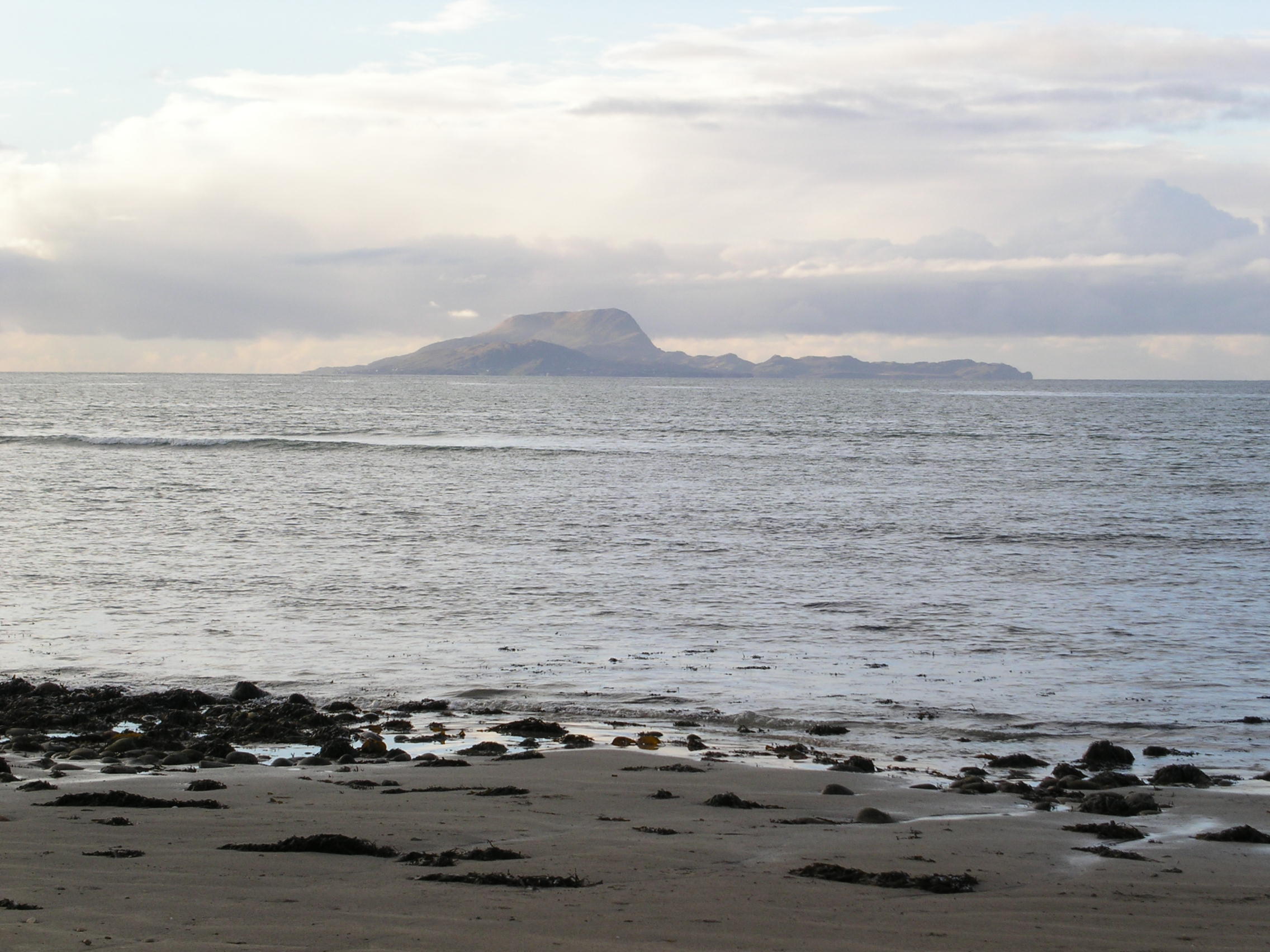
Clare Island from Clew Bay
 Clare Island (Ireland)
Geography Location Atlantic Ocean Coordinates 53.°48.13′N 9°59.17′W / 53.80217°N 9.98617°WCoordinates: 53.°48.13′N 9°59.17′W / 53.80217°N 9.98617°W Archipelago Clew Bay Total islands 117 Major islands Clare Island, Inishturk, Inishbofin, Inishark, Achillbeg, Caher Island Coastline 21 km (13 mi) Highest elevation 462 m (1,516 ft) Highest point Knockmore Country Republic of IrelandProvince Connacht County Mayo Demographics Population 125 Density 7.8 /km2 (20.2 /sq mi) Additional information Area: 3,949 acres Clare Island (Oileán Chliara in Irish) is a mountainous island guarding the entrance to Clew Bay in County Mayo, Ireland. It is famous as the home of the pirate queen, Gráinne O'Malley. Approximately 125 people live there today.
Southwest of Clare lies the uninhabited Caher Island and the inhabited Inishturk.
Contents
History
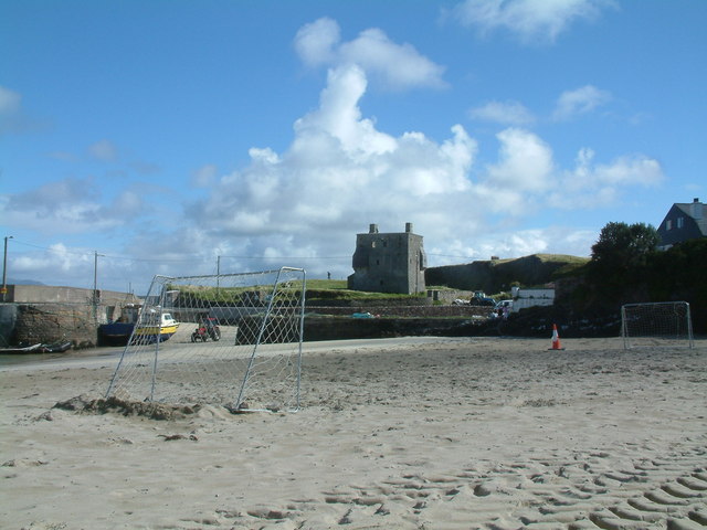
Through the Middle Ages, Clare Island was part of the lands of the O' Malley family. The ruins of an O'Malley tower-house, known as Gráinne O'Malley's castle because of its most famous resident, are close to the pier at the eastern edge of the island. The small Cistercian Abbey near the south coast of the island was founded by the O'Malleys and contains the O'Malley Tomb, a possible burial site of Gráinne O'Malley. The Abbey is known for its rare medieval roof paintings. In 1588 a ship from the Spanish Armada was wrecked on Clare Island and its men were killed by the O' Malleys.
A very prominent landmark of the island is the Clare Island Lighthouse, established by John Denis Browne, the 1st Marquess of Sligo, in 1806. On 29 September 1813 a fire, caused by careless disposal of the oil-lamp wicks, destroyed part of the tower and the lantern. The rebuilt light was ready in 1818. In 1834 the tower was struck by lightning. After 159 years of faithful service the lighthouse was taken out of service on 28 September 1965, replaced by the modern Achillbeg Island lighthouse on the south side of Achill Island.
Fauna and Flora
Between 1909 and 1911, the Belfast naturalist Robert Lloyd Praeger led an exhaustive biological survey of the island (the Clare Island Survey, which was unprecedented at the time and served as a template for future studies. A new study of the Island was made in 1990 to 2005 and volume 6 was published in 2007.[1]
Transportation and Infrastructure
Clare Island is accessible by daily ferry services from Roonagh Pier near Louisburgh. The return trip costs €15 euro and you get a map of the island with your ticket.
The island has a hotel, a few bed and breakfasts and a yoga and meditation centre. Maps are available for walkers and hill-walkers. The island is also suitable for exploration by bicycle, you can rent a bike in Glen (beside the pier) for €10 for the day.
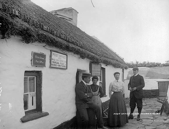
The island has its own primary school and a post office. Children go to the mainland for post-primary (secondary school) education.
Culture
The island also features in a famous song by the Irish folk-rock band, the Saw Doctors from their 1996 album, Same Oul Town. In the song, the band immortalise the island. It is described as a haven from hectic city life.
Gallery
-

Post office c. 1900
-

Gráinne O'Malley's castle
-
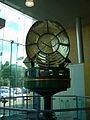
The optic from the Clare Island lighthouse now on permanent rotating display at The World of Glass gift shop, St. Helens, UK
-
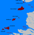
Islands off County Mayo
Click for larger view
References
- ^ Ed. Guiry, M.D., John, D.M., Rindi, F. and McCarthy, T. K. New Survey of Clare Islabd Volume 6: The Freshwater and Terrestrial Algae. Royln Irish Academy isbn 13: 978-1-904890-31-7
Further reading
- Guiry, M.D., John, D.M., Rindi, F. and McCarthy, T.K. (Edited) 2007. – New Survey of Clare Island. Volume 6: The Freshwater and Terrestrial Algae. – Royal Irish Academy. – ISBN 1904890317
External links
- Information site on Clare Island, updated regularly by an islander
- In this series of podcasts on Mayo's Heritage you can hear an excerpt from Ger Reidy's visit to Clare Island as part of his Heritage Tour of Clew Bay
Categories:- Islands of County Mayo
-


Wikimedia Foundation. 2010.