- Merzalben
-
Merzalben 
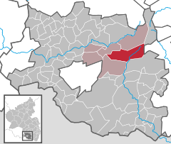
Coordinates 49.2445°N 7.7308°E / 49.2445°N 7.7308°ECoordinates: 49.2445°N 7.7308°E / 49.2445°N 7.7308°E Administration Country Germany State Rhineland-Palatinate District Südwestpfalz Municipal assoc. Rodalben Mayor Benno Schwarz (CDU) Basic statistics Area 30.01 km2 (11.59 sq mi) Elevation 281 m (922 ft) Population 1,239 (31 December 2010)[1] - Density 41 /km2 (107 /sq mi) Other information Time zone CET/CEST (UTC+1/+2) Licence plate PS Postal code 66978 Area code 06395 Website www.merzalben.de Merzalben is a municipality in Südwestpfalz district, in Rhineland-Palatinate, western Germany.
Merzalben's earliest known records were dated back from 1237.
Contents
Religion
2007 was 66.3% of the inhabitants Catholic and 19.3% Protestant. The remaining belonged of another religion or were denominationless.
Politics
The local council in Merzalben consists of 16 councillors, who were elected in the local election on 7 June 2009, and which honorary local mayor as chairmen
Culture
The 28 meters high Luitpoldturm was established 1909 on the summit to 607 meters high white mountain as observation tower. The castle Gräfenstein is a castle ruin of about two kilometers east of Merzalben. It gave its name to the region.
References
- ^ "Bevölkerung der Gemeinden am 31.12.2010" (in German). Statistisches Landesamt Rheinland-Pfalz. 31 December 2010. http://www.statistik.rlp.de/fileadmin/dokumente/berichte/A1033_201022_hj_G.pdf.
Categories:- Municipalities in Rhineland-Palatinate
- Südwestpfalz geography stubs
Wikimedia Foundation. 2010.


