- Barter Island Long Range Radar Station
Infobox Airport
name = Barter Island LRRS

IATA = BTI
ICAO = PABA
FAA = BTI
type = Public/Military
owner = North Slope Borough
operator =
city-served =
location =Barter Island ,Alaska
elevation-f = 2
elevation-m = 1
coordinates = coord|70|08|02|N|143|34|55|W|type:airport|display=inline
website =
r1-number = 7/25
r1-length-f = 4,820
r1-length-m = 1,469
r1-surface = Gravel
stat-year = 2005
stat1-header = Aircraft operations
stat1-data = 3,350
footnotes = Source:Federal Aviation Administration FAA-airport|ID=BTI|use=PU|own=MA|site=50055.5*A, effective 2007-07-05]Barter Island Long Range Radar Station Airport codes|BTI|PABA|BTI is a public/military
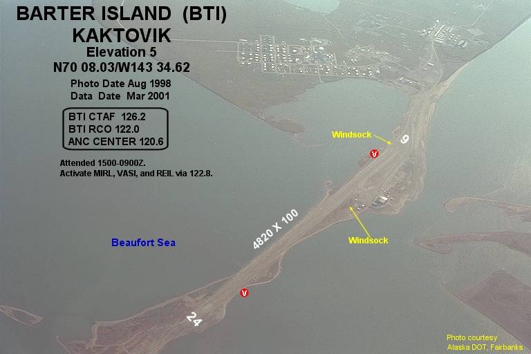
airport located near the city of Kaktovik onBarter Island , in the North Slope Borough of theU.S. state ofAlaska . The airport is owned by North Slope Borough. It is also known as Barter Island LRRS or Barter Island Airport.History
The original runway was built by the United States military in 1947. The
U.S. Air Force assumed control of Barter Island in 1951 and extended the runway in 1953 as part of the installation of aDistant Early Warning Line (DEW Line) radar station. [ [http://arcticcircle.uconn.edu/ANWR/anwrculthistory.html Arctic National Wildlife Refuge ] ] [http://arcticcircle.uconn.edu/Museum/Anthropology/Kaktovik/change.html]Facilities and aircraft
Barter Island LRRS has one
runway (7/25) with agravel surface measuring 4,820 x 100 ft. (1,469 x 30 m). For the 12-month period ending December 31, 2005, the airport had 3,350 aircraft operations, an average of 9 per day: 75%air taxi , 24%general aviation and 1% military.Airlines and non-stop destinations
*
Frontier Flying Service (Deadhorse, Fairbanks) [ [http://www.frontierflying.com/timetable-ffs.pdf Frontier Flying Service: 2007 Timetable] (PDF ). Retrieved 29-Aug-2007.]
*Hageland Aviation Services (Deadhorse) [ [http://www.hageland.com/07sched.pdf Hageland Aviation Services: Scheduled Flights] (PDF ). Retrieved 29-Aug-2007.]References
External links
* [http://www.lswilson.ca/barm.htm DEW Line Sites: Barter Island (BAR-Main)]
* [http://www.alaska.faa.gov/fai/images/ARPT_DIAGRAMS/BTI.gifFAA Alaska airport diagram] (GIF )
*
*
Wikimedia Foundation. 2010.
