- Welton, Iowa
Infobox Settlement
official_name = Welton, Iowa
settlement_type =City
nickname =
motto =
imagesize =
image_caption =
image_
imagesize =
image_caption =
image_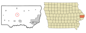
mapsize = 250px
map_caption = Location of Welton, Iowa
mapsize1 =
map_caption1 =subdivision_type = Country
subdivision_name =
subdivision_type1 = State
subdivision_name1 =
subdivision_type2 = County
subdivision_name2 = Clinton
government_footnotes =
government_type =
leader_title =
leader_name =
leader_title1 =
leader_name1 =
established_title =
established_date =unit_pref = Imperial
area_footnotes =area_magnitude =
area_total_km2 = 0.3
area_land_km2 = 0.3
area_water_km2 = 0.0
area_total_sq_mi = 0.1
area_land_sq_mi = 0.1
area_water_sq_mi = 0.0population_as_of = 2000
population_footnotes =
population_total = 159
population_density_km2 = 536.3
population_density_sq_mi = 1388.9timezone = Central (CST)
utc_offset = -6
timezone_DST = CDT
utc_offset_DST = -5
elevation_footnotes =
elevation_m = 212
elevation_ft = 696
latd = 41 |latm = 54 |lats = 44 |latNS = N
longd = 90 |longm = 36 |longs = 4 |longEW = Wpostal_code_type =
ZIP code
postal_code = 52774
area_code = 563
blank_name = FIPS code
blank_info = 19-83370
blank1_name = GNIS feature ID
blank1_info = 0462796
website =
footnotes =Welton is a city in Clinton County,
Iowa ,United States . The population was 159 at the 2000 census.The community is located adjacent to
U.S. Route 61 , which passes around Welton just to the east of the city. Prior to the rebuilding of the highway as a four lane highway, U.S. 61 went directly through the city. Following reconstruction of U.S. 61, a new truck stop was built adjacent to U.S. 61 near the southern edge of the city.On Wednesday, April 5, 2006 the 85-year-old Welton School was demolished. According to the Telegraph Herald newspaper, "the school was closed in 2005 because of budget problems and declining enrollment."
Geography
Welton is located at coor dms|41|54|44|N|90|36|4|W|city (41.912283, -90.601152)GR|1.
According to the
United States Census Bureau , the city has a total area of 0.1square mile s (0.3km² ), all of it land.Demographics
As of the
census GR|2 of 2000, there were 159 people, 57 households, and 47 families residing in the city. Thepopulation density was 1,388.9 people per square mile (558.1/km²). There were 60 housing units at an average density of 524.1/sq mi (210.6/km²). The racial makeup of the city was 97.48% White, 0.63% African American, and 1.89% from two or more races. Hispanic or Latino of any race were 0.63% of the population.There were 57 households out of which 38.6% had children under the age of 18 living with them, 64.9% were married couples living together, 10.5% had a female householder with no husband present, and 15.8% were non-families. 12.3% of all households were made up of individuals and 1.8% had someone living alone who was 65 years of age or older. The average household size was 2.79 and the average family size was 3.02.
In the city the population was spread out with 27.0% under the age of 18, 8.8% from 18 to 24, 28.9% from 25 to 44, 27.0% from 45 to 64, and 8.2% who were 65 years of age or older. The median age was 32 years. For every 100 females there were 89.3 males. For every 100 females age 18 and over, there were 96.6 males.
The median income for a household in the city was $48,750, and the median income for a family was $42,500. Males had a median income of $39,688 versus $22,083 for females. The
per capita income for the city was $17,680. None of the population or families were below thepoverty line .References
External links
Wikimedia Foundation. 2010.