- Elberfeld, Indiana
Infobox Settlement
official_name = Town of Elberfeld, Indiana
settlement_type =Town
nickname =
mapsize = 250x200px
imagesize =
image_caption =
imagesize =
image_caption =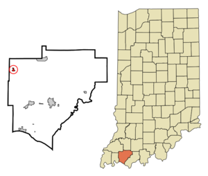
map_caption = Location in the state ofIndiana
mapsize1 =
map_caption1 =
subdivision_type = Country
subdivision_name =United States
area_note =
subdivision_type1 = State
subdivision_name1 =Indiana
subdivision_type2 = County
subdivision_name2 = Warrick
subdivision_type3 = Township
subdivision_name3 = Greer
government_type =
leader_title =
leader_name =
established_date =
area_magnitude = 1 E5
area_total_km2 = 0.8
area_land_km2 = 0.8
area_water_km2 = 0.0
population_as_of = 2000
population_note =
population_total = 636
population_density_km2 = 792.1
timezone = CST
utc_offset = -6
timezone_DST = CDT
utc_offset_DST = -5
area_total_sq_mi = 0.3
area_land_sq_mi = 0.3
area_water_sq_mi = 0.0
elevation_m = 138
elevation_ft = 453
latd = 38 |latm = 9 |lats = 36 |latNS = N
longd = 87 |longm = 26 |longs = 51 |longEW = W
postal_code_type =ZIP code
postal_code = 47613
area_code = 812
blank_name = FIPS code
blank_info = 18-20638GR|2
blank1_name = GNIS feature ID
blank1_info = 0434059GR|3
footnotes =
website =Elberfeld is a town in Greer Township, Warrick County,
Indiana ,United States . The population was 636 at the 2000 census. It was founded in 1885 by German immigrants and named forElberfeld , Germany.Geography
Elberfeld is located at coor dms|38|9|36|N|87|26|51|W|city (38.160067, -87.447609)GR|1.
According to the
United States Census Bureau , the town has a total area of 0.3square mile s (0.8km² ), all of it land.Demographics
As of the
census GR|2 of 2000, there were 636 people, 261 households, and 192 families residing in the town. Thepopulation density was 2,050.7 people per square mile (792.1/km²). There were 271 housing units at an average density of 873.8/sq mi (337.5/km²). The racial makeup of the town was 99.69% White, 0.16% Asian and 0.16% Pacific Islander. Hispanic or Latino of any race were 0.31% of the population.There were 261 households out of which 28.0% had children under the age of 18 living with them, 61.7% were married couples living together, 9.6% had a female householder with no husband present, and 26.4% were non-families. 23.0% of all households were made up of individuals and 11.1% had someone living alone who was 65 years of age or older. The average household size was 2.44 and the average family size was 2.88.
In the town the population was spread out with 21.9% under the age of 18, 9.0% from 18 to 24, 28.0% from 25 to 44, 28.0% from 45 to 64, and 13.2% who were 65 years of age or older. The median age was 40 years. For every 100 females there were 98.8 males. For every 100 females age 18 and over, there were 94.1 males.
The median income for a household in the town was $40,833, and the median income for a family was $47,292. Males had a median income of $38,250 versus $21,063 for females. The
per capita income for the town was $19,236. About 4.3% of families and 4.2% of the population were below thepoverty line , including 3.2% of those under age 18 and none of those age 65 or over.References
External links
Wikimedia Foundation. 2010.