- Patriot, Indiana
Infobox Settlement
official_name = Patriot, Indiana
settlement_type =Town
nickname =
motto =
imagesize =
image_caption =
image_
imagesize =
image_caption =
image_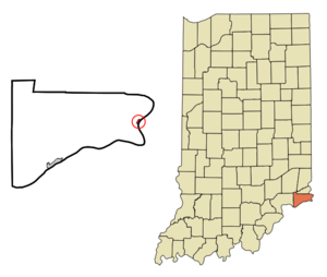
mapsize = 250x200px
map_caption = Location of Patriot in the state ofIndiana
mapsize1 =
map_caption1 =subdivision_type = Country
subdivision_name =United States
subdivision_type1 = State
subdivision_name1 =Indiana
subdivision_type2 = County
subdivision_name2 = Switzerland
subdivision_type3 = Township
subdivision_name3 = Posey
government_footnotes =
government_type =
leader_title =
leader_name =
leader_title1 =
leader_name1 =
established_title =
established_date =area_footnotes =
unit_pref = Imperial
area_magnitude =
area_total_km2 = 0.7
area_land_km2 = 0.6
area_water_km2 = 0.1
area_total_sq_mi = 0.3
area_land_sq_mi = 0.2
area_water_sq_mi = 0.0population_as_of = 2000
population_footnotes =
population_total = 202
population_density_km2 = 350.1
population_density_sq_mi = 906.7timezone = Eastern (EST)
utc_offset = -5
timezone_DST = EDT
utc_offset_DST = -4
elevation_footnotes =
elevation_m = 144
elevation_ft = 472
latd = 38 |latm = 50 |lats = 18 |latNS = N
longd = 84 |longm = 49 |longs = 40 |longEW = Wpostal_code_type =
ZIP code
postal_code = 47038
area_code = 812
blank_name = FIPS code
blank_info = 18-58392GR|2
blank1_name = GNIS feature ID
blank1_info = 0440929GR|3
website =
footnotes =Patriot is a town in Posey Township, Switzerland County,
Indiana , along theOhio River . The population was 202 at the 2000 census.Geography
Patriot is located at coor dms|38|50|18|N|84|49|40|W|city (38.838215, -84.827764)GR|1.
According to the
United States Census Bureau , the town has a total area of 0.3square mile s (0.7km² ), of which, 0.2 square miles (0.6 km²) of it is land and 0.04 square miles (0.1 km²) of it (15.38%) is water.Demographics
As of the
census GR|2 of 2000, there were 202 people, 73 households, and 60 families residing in the town. Thepopulation density was 906.7 people per square mile (354.5/km²). There were 108 housing units at an average density of 484.8/sq mi (189.5/km²). The racial makeup of the town was 98.02% White, 0.50% African American, 0.50% Native American, and 0.99% from two or more races. Hispanic of any race were 0.99% of the population.There were 73 households out of which 38.4% had children under the age of 18 living with them, 63.0% were married couples living together, 13.7% had a female householder with no husband present, and 17.8% were non-families. 13.7% of all households were made up of individuals and 2.7% had someone living alone who was 65 years of age or older. The average household size was 2.77 and the average family size was 3.00.
In the town the population was spread out with 27.2% under the age of 18, 8.9% from 18 to 24, 29.7% from 25 to 44, 26.2% from 45 to 64, and 7.9% who were 65 years of age or older. The median age was 36 years. For every 100 females there were 114.9 males. For every 100 females age 18 and over, there were 113.0 males.
The median income for a household in the town was $37,500, and the median income for a family was $38,438. Males had a median income of $29,135 versus $26,071 for females. The
per capita income for the town was $16,866. About 6.0% of families and 10.4% of the population were below thepoverty line , including 17.6% of those under the age of eighteen and none of those sixty five or over.Notable native
*
Elwood Mead -Head of theUnited States Bureau of Reclamation from 1924 to 1936. He oversaw construction ofHoover Dam .ee also
*
List of cities and towns along the Ohio River References
External links
Wikimedia Foundation. 2010.