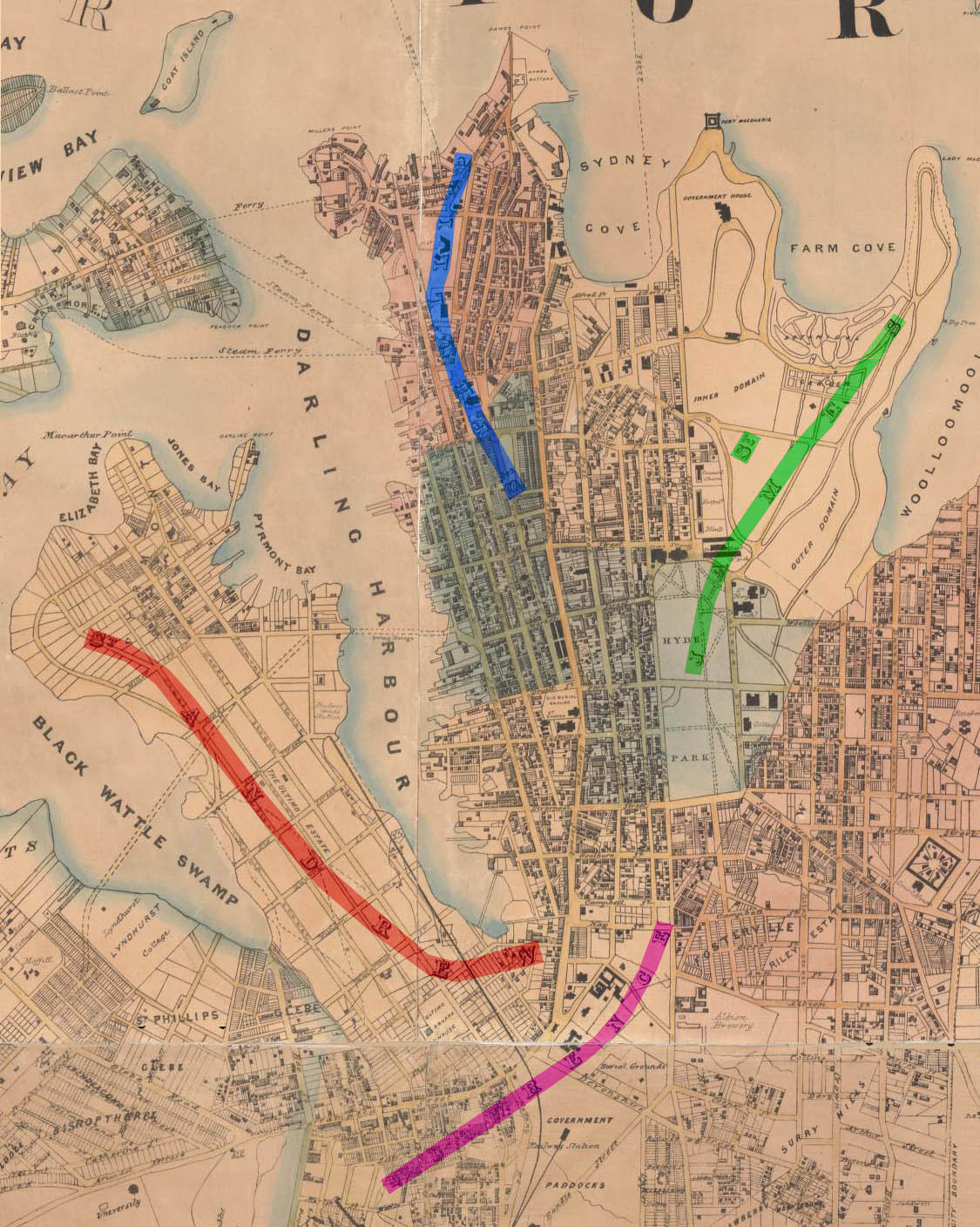
St. Lawrence Parish, Cumberland
- St. Lawrence Parish, Cumberland
Infobox Australian cadastral
name = St. Lawrence
state = New South Wales

imagesize = 180px
caption = Location in Sydney city highlighted in magenta
lga = City of Sydney
county = Cumberland
former hundred = Sydney
est = 1835
near-nw = St. Philip
near-n = St. James
near-ne = St. James
near-e = Alexandria
near-se = Alexandria
near-s = Alexandria
near-sw = Alexandria
near-w = St. Andrew
St. Lawrence Parish, Cumberland is one of the 57 parishes of Cumberland County, New South Wales, a cadastral unit for use on land titles. It is one of the four small parishes in the Sydney city area. Unlike the other three parishes, St. Lawrence was not named after a church, but instead due to confusion over the naming, the parish gave its name to the Christ Church St. Laurence. This had been controversial in the nineteenth century, as it meant the Anglican church was given a catholic saints name. [ [http://www.ccsl.org.au/index.php?option=com_content&task=view&id=118&Itemid=179 The Naming of the Parish, Christ Church of St.Laurence] ]
The area of the parish includes Central station, Museum station, the southern part of Hyde Park below Park street, and Prince Alfred Park. The parish is bounded by George Street in the west, Park Street and a small part of William Street in the north, a line from the intersection of Yurong and William streets to the intersection of Albion and Elizabeth Street in the east, also part of Elizabeth Street forms the boundary further south, as well as Chalmers Street. Regent Street is the boundary in the south west. [Information obtained from [http://www.lands.nsw.gov.au/survey_mapping/maps_and_imagery/parish_maps maps available at the NSW Dept. of Lands Parish map preservation project] ] . It includes the ANZAC War Memorial. [ [http://www.austlii.edu.au/au/legis/nsw/consol_act/ama1923209.txt/cgi-bin/download.cgi/download/au/legis/nsw/consol_act/ama1923209.txt Anzac memorial building act 1923] , Austlii] The parish is relatively thin east-west, so that Central railway station nearly covers the entire width of the parish.
Images
Images of locations in the Parish of St. Lawrence:
References
* [http://www.gnb.nsw.gov.au/name_search/extract?id=KWcklMWAGH Geographic Names Board of New South Wales]
Wikimedia Foundation.
2010.
Look at other dictionaries:
St. James Parish, Cumberland — Infobox Australian cadastral name = St. James state = New South Wales imagesize = 180px caption = Location in Sydney city highlighted in green lga = City of Sydney county = Cumberland former hundred = Sydney est = 1835 near nw = St. Philip near n … Wikipedia
St. Andrew Parish, Cumberland — Infobox Australian cadastral name = St. Andrew state = New South Wales imagesize = 180px caption = Location in Sydney city highlighted in red on an 1857 map lga = City of Sydney county = Cumberland former hundred = Sydney est = 1835 near nw =… … Wikipedia
Alexandria Parish, Cumberland — Infobox Australian cadastral name = Alexandria state = New South Wales imagesize = 180 caption = Location of the parish within Cumberland lga = Woollahra, Waverley county = Cumberland former hundred = Sydney est = 1835 near nw = St. Lawrence near … Wikipedia
Cumberland County, New South Wales — Map of all coordinates from Google Map of all coordinates from Bing Export all coordinates as KML … Wikipedia
National Register of Historic Places listings in Cumberland County, Maine — Location of Cumberland County in Maine This is a list of the National Register of Historic Places listings in Cumberland County, Maine. This is intended to be a complete list of the properties and districts on the National Register of Historic… … Wikipedia
Waltham St Lawrence — is a small village and civil parish in the English county of Berkshire.Location and amenitiesWaltham St Lawrence is located in a rural setting in East Berkshire, south of the A4 trunk road and north of the M4 motorway, between Maidenhead and… … Wikipedia
List of Registered Historic Places in Cumberland County, Maine — List of Registered Historic Places in Cumberland County, Maine::: This National Park Service list is complete through [http://www.nps.gov/history/nr/nrlist.htm NPS recent listings] posted September 26, 2008. [cite web… … Wikipedia
Joshua Lawrence Chamberlain — (* 8. September 1828 in Brewer, Penobscot County, Maine; † 24. Februar 1914 in Portland, Maine) war General des US Heeres während des Bürgerkrieges und … Deutsch Wikipedia
List of U.S. counties in alphabetical order — NOTOC A*Abbeville County, South Carolina *Acadia Parish, Louisiana *Accomack County, Virginia *Ada County, Idaho *Adair County, Iowa *Adair County, Kentucky * Adair County, Missouri * Adair County, Oklahoma *Adams County, Colorado * Adams County … Wikipedia
United Kingdom — a kingdom in NW Europe, consisting of Great Britain and Northern Ireland: formerly comprising Great Britain and Ireland 1801 1922. 58,610,182; 94,242 sq. mi. (244,100 sq. km). Cap.: London. Abbr.: U.K. Official name, United Kingdom of Great… … Universalium

