- West Baden Springs, Indiana
Infobox Settlement
official_name = West Baden Springs, Indiana
settlement_type =Town
nickname =
motto =
imagesize =
image_caption =
image_
imagesize =
image_caption =
image_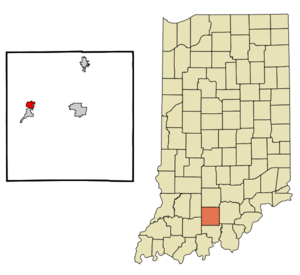
mapsize = 250x200px
map_caption = Location of West Baden Springs in the state ofIndiana
mapsize1 =
map_caption1 =subdivision_type = Country
subdivision_name =United States
subdivision_type1 = State
subdivision_name1 =Indiana
subdivision_type2 = County
subdivision_name2 = Orange
subdivision_type3 = Township
subdivision_name3 = French Lick
government_footnotes =
government_type =
leader_title =
leader_name =
leader_title1 =
leader_name1 =
established_title =
established_date =area_footnotes =
unit_pref = Imperial
area_magnitude =
area_total_km2 = 2.8
area_land_km2 = 2.8
area_water_km2 = 0.0
area_total_sq_mi = 1.1
area_land_sq_mi = 1.1
area_water_sq_mi = 0.0population_as_of = 2000
population_footnotes =
population_total = 618
population_density_km2 = 223.1
population_density_sq_mi = 577.8timezone = Eastern (EST)
utc_offset = -5
timezone_DST = EDT
utc_offset_DST = -4
elevation_footnotes =
elevation_m = 146
elevation_ft = 479
latd = 38 |latm = 34 |lats = 1 |latNS = N
longd = 86 |longm = 36 |longs = 42 |longEW = Wpostal_code_type =
ZIP code
postal_code = 47469
area_code = 812
blank_name = FIPS code
blank_info = 18-82376GR|2
blank1_name = GNIS feature ID
blank1_info = 0451617GR|3
website =
footnotes =West Baden Springs is a town in French Lick Township, Orange County,
Indiana ,United States . The population was 618 at the 2000 census. It is home ofNBA legendLarry Bird .Geography
West Baden Springs is located at coor dms|38|34|1|N|86|36|42|W|city (38.567018, -86.611601)GR|1.
According to the
United States Census Bureau , the town has a total area of 1.1square mile s (2.8km² ), all of it land.Demographics
As of the
census GR|2 of 2000, there were 618 people, 263 households, and 175 families residing in the town. Thepopulation density was 577.8 people per square mile (223.0/km²). There were 292 housing units at an average density of 273.0/sq mi (105.4/km²). The racial makeup of the town was 94.50% White, 2.10% African American, 0.81% Native American, 0.81% Asian, 1.13% from other races, and 0.65% from two or more races. Hispanic or Latino of any race were 3.07% of the population.There were 263 households out of which 24.7% had children under the age of 18 living with them, 50.2% were married couples living together, 10.6% had a female householder with no husband present, and 33.1% were non-families. 29.3% of all households were made up of individuals and 16.0% had someone living alone who was 65 years of age or older. The average household size was 2.35 and the average family size was 2.88.
In the town the population was spread out with 21.7% under the age of 18, 8.3% from 18 to 24, 27.7% from 25 to 44, 26.5% from 45 to 64, and 15.9% who were 65 years of age or older. The median age was 40 years. For every 100 females there were 93.1 males. For every 100 females age 18 and over, there were 92.1 males.
The median income for a household in the town was $32,750, and the median income for a family was $40,357. Males had a median income of $29,444 versus $19,375 for females. The
per capita income for the town was $14,532. About 10.3% of families and 9.7% of the population were below thepoverty line , including 6.8% of those under age 18 and 13.5% of those age 65 or over.West Baden Springs Hotel
Prior to the completion of the
Houston Astrodome in 1965, the building had the largest free-spanning dome in the United States and was the World's largest dome from 1902-1913.The property underwent a complete renovation as a part of the
French Lick Resort Casino . The Resort and Casino opened in November 2006, and the restored West Baden Springs Hotel was reopened to guests in late May 2007.References
External links
* [http://www.cookgroup.com/historic_landmarks/index.html |West Baden Springs Hotel]
Wikimedia Foundation. 2010.