- Lyons, Indiana
Infobox Settlement
official_name = Town of Lyons, Indiana
settlement_type =Town
nickname =
mapsize = 250x200px
imagesize =
image_caption =
imagesize =
image_caption =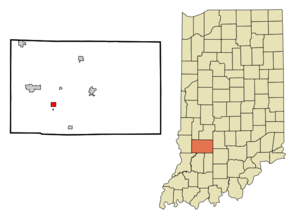
map_caption = Location in the state ofIndiana
mapsize1 =
map_caption1 =
subdivision_type = Country
subdivision_name =United States
area_footnotes =
unit_pref = Imperial
subdivision_type1 = State
subdivision_name1 =Indiana
subdivision_type2 = County
subdivision_name2 = Greene
subdivision_type3 = Township
subdivision_name3 = Washington
government_type =
leader_title =
leader_name =
established_date =
area_magnitude =
area_total_km2 = 2.3
area_land_km2 = 2.3
area_water_km2 = 0.0
population_as_of = 2000
population_note =
population_total = 748
population_density_km2 = 332
timezone = EST
utc_offset = -5
timezone_DST = EST
utc_offset_DST = -5
area_total_sq_mi = 0.9
area_land_sq_mi = 0.9
area_water_sq_mi = 0.0
elevation_m = 162
elevation_ft = 531
latd = 38 |latm = 59 |lats = 19 |latNS = N
longd = 87 |longm = 4 |longs = 56 |longEW = W
postal_code_type =ZIP code
postal_code = 47443
area_code = 812
blank_name = FIPS code
blank_info = 18-45504GR|2
blank1_name = GNIS feature ID
blank1_info = 0438441GR|3
footnotes =
website = www.visitgreenein.comLyons is a town in Washington Township, Greene County,
Indiana ,United States . The population was 748 at the 2000 census.Geography
Lyons is located at coor dms|38|59|19|N|87|4|56|W|city (38.988685, -87.082211)GR|1.
According to the
United States Census Bureau , the town has a total area of 0.9square mile s (2.3km² ), all of it land.Demographics
As of the
census GR|2 of 2000, there were 748 people, 281 households, and 198 families residing in the town. Thepopulation density was 864.5 people per square mile (332.0/km²). There were 322 housing units at an average density of 372.2/sq mi (142.9/km²). The racial makeup of the town was 98.93% White, 0.27% Native American, 0.40% Asian, 0.13% from other races, and 0.27% from two or more races. Hispanic or Latino of any race were 0.80% of the population.There were 281 households out of which 34.2% had children under the age of 18 living with them, 54.1% were married couples living together, 11.0% had a female householder with no husband present, and 29.2% were non-families. 26.0% of all households were made up of individuals and 15.3% had someone living alone who was 65 years of age or older. The average household size was 2.48 and the average family size was 2.93.
In the town the population was spread out with 26.1% under the age of 18, 7.1% from 18 to 24, 25.0% from 25 to 44, 21.5% from 45 to 64, and 20.3% who were 65 years of age or older. The median age was 38 years. For every 100 females there were 87.5 males. For every 100 females age 18 and over, there were 79.5 males.
The median income for a household in the town was $25,592, and the median income for a family was $30,139. Males had a median income of $25,909 versus $18,125 for females. The
per capita income for the town was $12,771. About 20.1% of families and 20.7% of the population were below thepoverty line , including 31.7% of those under age 18 and 15.0% of those age 65 or over.References
External links
* [http://www.wrv.k12.in.us/ White River Valley School Corporation]
* [http://www.gcdailyworld.com/ Greene County Daily World Newspaper]
* [http://www.greenecountynet.org/economicdev.htm Greene County Economic Development Corporation]
Wikimedia Foundation. 2010.