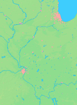
- Mounds, Illinois
-
Mounds City Country United States State Illinois County Pulaski Coordinates 37°6′53″N 89°11′57″W / 37.11472°N 89.19917°W Area 1.2 sq mi (3 km2) - land 1.2 sq mi (3 km2) Population 1,117 (2000) Density 918.9 / sq mi (355 / km2) Timezone CST (UTC-6) - summer (DST) CDT (UTC-5) Postal code 62964 Area code 618 Wikimedia Commons: Mounds, Illinois Mounds is a city in Pulaski County, Illinois, United States. The population was 1,117 in the 2000 census.
Contents
Geography
Mounds is located at 37°6′53″N 89°11′57″W / 37.11472°N 89.19917°W (37.114838, -89.199030).[1]
According to the United States Census Bureau, the city has a total area of 1.2 square miles (3.1 km2), all land.
History
The town was named for the prehistoric monumental earthwork mounds in the area, likely built by the Mississippian culture about 1000 CE. Mound building had started earlier, before the Common Era, but Mississippian sites were located throughout the Lower Mississippian Valley and the tributaries of the river, as along the Ohio River.
European-Americans settled southern Illinois by traveling along the Ohio River, mostly from the states of Kentucky and Tennessee, and other of the Upper South. At one time this area of the state was called "Little Dixie" because of the preponderance of southerners. Because Illinois entered the union as a free state, African-American slaves sometimes escaped to it across the Ohio and Mississippi rivers to freedom, sometimes traveling as far as Canada to ensure they evaded slave catchers. Other blacks settled in the area in the late nineteenth century because of jobs available with the railroad in Pulaski and Cairo, Illinois. Mounds had a round house and maintenance jobs associated with the railroad.
Demographics
As of the 2000 census,[2] there were 1,117 people, 407 households, and 264 families residing in the city. The population density was 918.9 people per square mile (353.5/km²). There were 504 housing units at an average density of 414.6 per square mile (159.5/km²). The racial makeup of the city was 36.53% White, 60.61% African American, 0.18% Native American, 0.18% Asian, 0.45% from other races, and 2.06% from two or more races. Hispanic or Latino of any race were 1.07% of the population.
There were 407 households out of which 36.1% had children under the age of 18 living with them, 35.1% were married couples living together, 24.6% had a female householder with no husband present, and 35.1% were non-families. 31.9% of all households were made up of individuals and 15.5% had someone living alone who was 65 years of age or older. The average household size was 2.62 and the average family size was 3.33.
In the city the population was spread out with 33.4% under the age of 18, 7.9% from 18 to 24, 22.2% from 25 to 44, 18.3% from 45 to 64, and 18.3% who were 65 years of age or older. The median age was 33 years. For every 100 females there were 83.1 males. For every 100 females age 18 and over, there were 75.5 males.
The median income for a household in the city was $17,727, and the median income for a family was $20,125. Males had a median income of $27,500 versus $16,250 for females. The per capita income for the city was $11,035. About 38.1% of families and 42.8% of the population were below the poverty line, including 59.7% of those under age 18 and 19.6% of those age 65 or over.
Education
The high school is located between Mounds and Mound City east of I-57. Meridian High School school serves grades 9-12.
References
- ^ "US Gazetteer files: 2010, 2000, and 1990". United States Census Bureau. 2011-02-12. http://www.census.gov/geo/www/gazetteer/gazette.html. Retrieved 2011-04-23.
- ^ "American FactFinder". United States Census Bureau. http://factfinder.census.gov. Retrieved 2008-01-31.
External links
Municipalities and communities of Pulaski County, Illinois Cities Mound City | Mounds
Villages Karnak | New Grand Chain | Olmsted | Pulaski | Ullin
Precincts America | Grand Chain | Karnak | Mound City | Mounds | Olmsted | Perks | Pulaski | Ullin | Villa Ridge | Wetaug
Unincorporated
communitiesAmerica | Levings | North Mounds | Perks | Pryortown | Spencer Heights | Villa Ridge | Wetaug
Ghost town Tacaogane
Categories:- Cities in Illinois
- Populated places in Pulaski County, Illinois
- Populated places in Illinois with African American majority populations
Wikimedia Foundation. 2010.


