North East Island, New Zealand
- North East Island, New Zealand
-

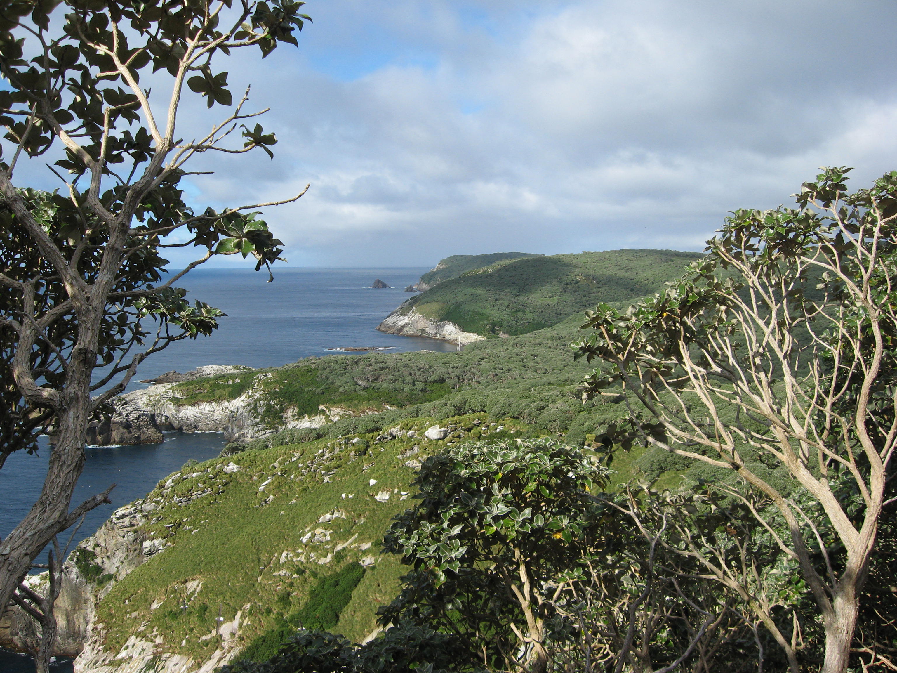
Looking South across North East Island -
across Punui Bay,
Ho Ho Bay,
Mollymawk Bay then Broughton Island the last wooded land.
North East Island
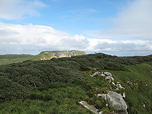
Looking to the highest point in the West, across North East Island. |
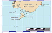
The position of The Snares relative to New Zealand |
| Geography |
| Coordinates |
48°01′S 166°36′E / 48.017°S 166.6°E / -48.017; 166.6 |
| Archipelago |
Snares Islands |
| Length |
3 km (1.9 mi) |
| Width |
2.5 km (1.55 mi) |
| Highest elevation |
130.0 m (426.5 ft) |
| Country |
|
|
| Demographics |
| Population |
0 |
The North East Island is the main island of the Snares Island group at 48°01′S 166°36′E / 48.017°S 166.6°E / -48.017; 166.6 approximately 200 kilometres (120 mi) south of New Zealand's South Island. The island forms a central triangle with peninsulas to the north, south and to the west and is some 3 by 2.5 km (1.9 by 1.6 mi) long by wide. Off the South Promontory lies Broughton Island, the second largest island in the group. South off the western peninsula coast lies the islet Alert Stack and off the North Promontory lies the North and South Daption Rocks.
The highest elevation of 130 m (427 ft) is at the western peninsula.
See also
References
External links
Categories: - Snares Islands / Tini Heke
- New Zealand outlying island geography stubs
Wikimedia Foundation.
2010.
Look at other dictionaries:
North East Island — Blick über North East Island Richtung Westen auf den höchsten Punkt der Insel Gewässer … Deutsch Wikipedia
North East Island — may refer to: North East Island National Park, Queensland, Australia North East Island, New Zealand, main island of the Snares Island group North East Isle (Tasmania), Australia North East Penang Island, Malaysia North and East Island group,… … Wikipedia
East Coast (New Zealand electorate) — East Coast is a New Zealand Parliamentary electorate, returning one Member of Parliament to the New Zealand House of Representatives. The electorate first existed from 1871 to 1893. From 1996 to 2002, the electorate was called Mahia. The current… … Wikipedia
Broughton Island, New Zealand — Broughton Island is the second largest island of The Snares, at coord|48|02|10|S|166|37|0|E| just off the South Promontory of the main island North East Island, which lies approximately 200 kilometres south of New Zealand s South Island. The… … Wikipedia
New Zealand — New Zealander. /zee leuhnd/ a country in the S Pacific, SE of Australia, consisting of North Island, South Island, and adjacent small islands: a member of the Commonwealth of Nations. 3,587,275; 103,416 sq. mi. (267,845 sq. km). Cap.: Wellington … Universalium
New Zealand Robin — South Island Robin (Petroica australis australis) Conservation status … Wikipedia
New Zealand and the United Nations — New Zealand Membership Full member Since 1945 … Wikipedia
New Zealand dollar — Tāra o Aotearoa (Māori) ISO 4217 code NZD User(s) New Zealand … Wikipedia
New Zealand Defence Force — Te Ope Kaatua o Aotearoa Service branches Royal New Zealand Navy New Zealand Army Royal New Zealand Air Force Headquarters Wellington Leadership Com … Wikipedia
Campbell Island, New Zealand — Campbell Island ( Motu Ihupuku ) is a remote, sub Antarctic island of New Zealand and the main island of the Campbell Island group. Campbell Island proper is located at coord|52|32.4|S|169|8.7|E|. It covers 115 km² and is surrounded by numerous… … Wikipedia