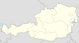
- Otterthal
-
Otterthal Country Austria State Lower Austria District Neunkirchen Mayor Karl Mayerhofer (ÖVP) Area 6.16 km2 (2 sq mi) Elevation 632 m (2074 ft) Population 598 (1 January 2011)[1] - Density 97 /km² (251 /sq mi) Time zone CET/CEST (UTC+1/+2) Licence plate NK Postal code 2880 Area code 02641 Website www.otterthal.at Coordinates: 47°37′00″N 15°55′00″E / 47.6166667°N 15.9166667°E
Otterthal is a town in Austria. Situated in Lower Austria, it is in the industrial part of Lower Austria. 61.72 percent of the municipality is forested.
Contents
Districts
- Neunkirchen
Historical population of Otterthal
- 1971: 453
- 1981: 526
- 1991: 628
- 2001: 563
History
In ancient times, it was part of the Roman province of Noricum.
Other
There are 126 companies. 255 persons are employed. The activity rate was 48.31%.
References
Municipalities in the district of Neunkirchen Altendorf · Aspang-Markt · Aspangberg-Sankt Peter · Breitenau · Breitenstein · Buchbach · Bürg-Vöstenhof · Edlitz · Enzenreith · Feistritz am Wechsel · Gloggnitz · Grafenbach-Sankt Valentin · Grimmenstein · Grünbach am Schneeberg · Höflein an der Hohen Wand · Kirchberg am Wechsel · Mönichkirchen · Natschbach-Loipersbach · Neunkirchen · Otterthal · Payerbach · Pitten · Prigglitz · Puchberg am Schneeberg · Raach am Hochgebirge · Reichenau an der Rax · Scheiblingkirchen-Thernberg · Schottwien · Schrattenbach · Schwarzau am Steinfeld · Schwarzau im Gebirge · Seebenstein · Semmering · Sankt Corona am Wechsel · Sankt Egyden am Steinfeld · Ternitz · Thomasberg · Trattenbach · Warth · Wartmannstetten · Willendorf · Wimpassing im Schwarzatale · Würflach · Zöbern
Categories:- Cities and towns in Lower Austria
- Lower Austria geography stubs
Wikimedia Foundation. 2010.


