- Mount Washington State Park
-
Mount Washington State Park 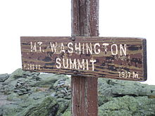
The summit of Mount Washington is frequently obscured by clouds.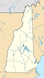

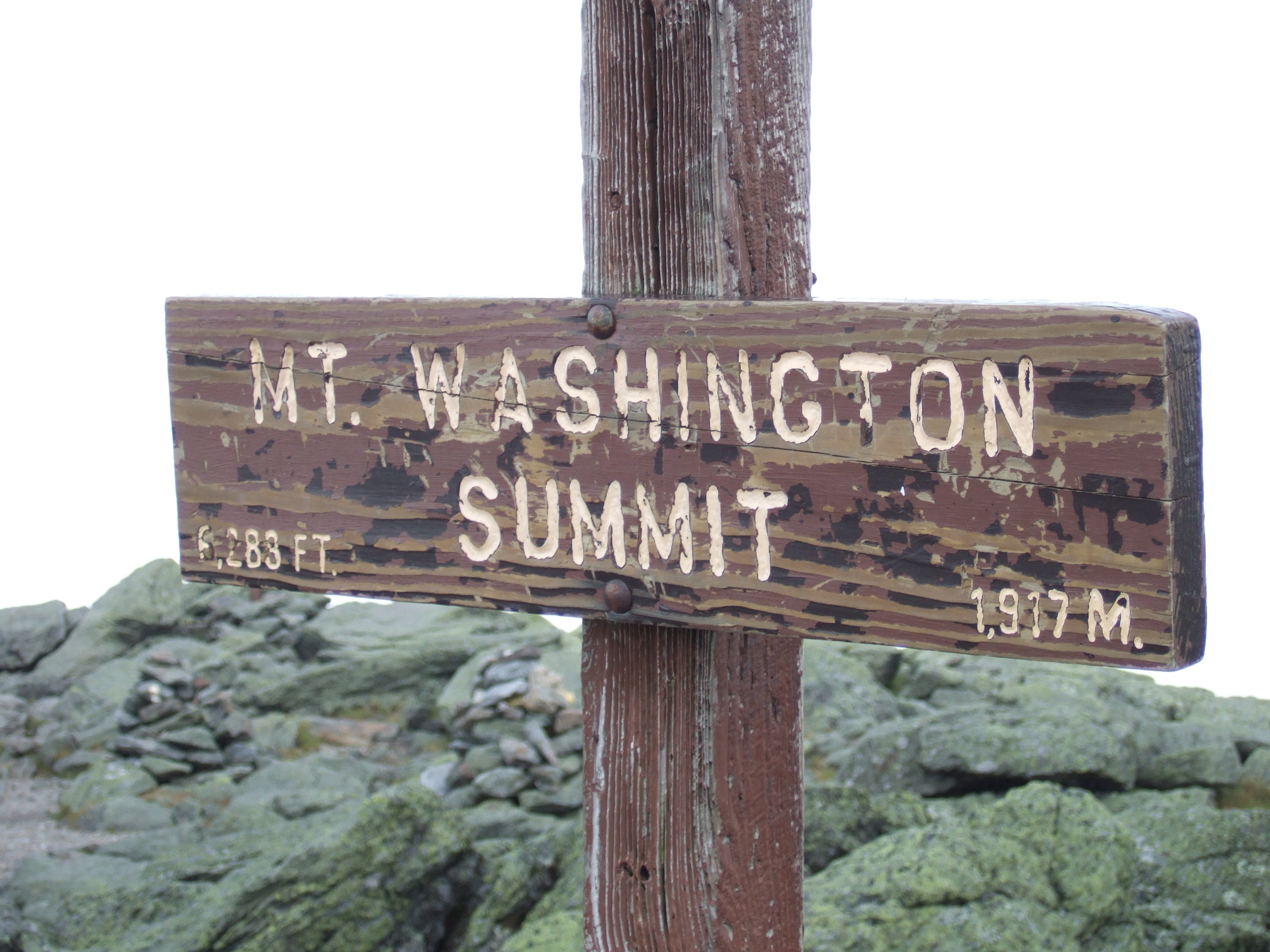
Type State park Location Mount Washington, New Hampshire Coordinates 44°16′10″N 71°18′06″W / 44.269419°N 71.301699°WCoordinates: 44°16′10″N 71°18′06″W / 44.269419°N 71.301699°W Area 59 acres (24 ha) Created 1964 Operated by New Hampshire Division of Parks and Recreation Open May to October, 8 a.m. to 6 p.m. Mount Washington State Park is a 59-acre (24 ha) parcel perched on the summit of Mount Washington, the highest peak in the northeastern United States. Summer seasonal amenities include a cafeteria, restrooms, gift shops, the Mount Washington Observatory and its museum. The historic Tip Top House is located adjacent to the summit building and is open (small fee) to visitors from early May to early October. The park is accessible by the Mount Washington Auto Road, the Mount Washington Cog Railway, the Appalachian Trail, or numerous other hiking trails from surrounding trailheads including Pinkham Notch, Crawford Notch and the Cog Railway base station.
The land forming the park was originally given to Dartmouth College in 1951 by the estate of the owner of the Cog Railway. Dartmouth sold 59 acres (240,000 m2) to the State of New Hampshire in 1964 for use as a park and then sold the final 8 acres (32,000 m2) in 2008 for $2.1M, after a long-term broadcasting lease had expired. A small segment of the summit is still owned by the Cog Railway and used as the upper terminus of the railway.[1]
History
In 1642, Darby Field was the first to climb to the summit of Mount Washington. He supposedly had guidance by the Native Americans.
Construction of the auto road started in 1854. When funds ran out in 1856, the current Mount Washington Summit Road Company completed building it in 1859. At that time, summit buildings were also erected. The Cog Railway completed construction in 1869. In 1908 a major fire destroyed all of the buildings but one; the Tip Top House.[2]
References
- ^ Lorna Colquhoun (July 3, 2008). "Dartmouth sells Mt. Washington summit land to state". New Hampshire Union Leader. http://www.unionleader.com/pda-article.aspx?articleId=f3aa3f74-f476-40f5-8379-59aba0eff137. Retrieved 2005-02-05.
- ^ Rick Russack. "Fire on Mount Washington". WhiteMountainHistory.org. http://whitemountainhistory.org/Fire_On_Mt.html. Retrieved June 15, 2011.
External links
Federal National Historic SiteNational Wildlife RefugesGreat Bay • John Hay • Silvio O. Conte • Umbagog • Wapack
Other Protected AreasGreat Bay National Estuarine Research ReserveState Ahern • Androscoggin • Annett • Bear Brook • Bear's Den • Beaver Brook Falls • Bedell Bridge • Binney Pond • Bradford Pines • Cardigan • Cathedral Ledge • Chesterfield Gorge • Clough • Coleman • Crawford Notch • Crosby Mountain • Curtiss Dogwood • Daniel Webster Birthplace • Deer Mountain Campground • Dixville Notch • Dublin Lake • Echo Lake • Eisenhower Memorial • Ellacoya • Endicott Rock • Forest Lake • Fort Constitution • Fort Stark • Franconia Notch • Franklin Pierce Homestead • Gardner Memorial Wayside • Governor Wentworth Historical Site • Greenfield • Hampton Beach • Hannah Duston • Heath Pond Bog • Humphrey's Ledge • Jenness • Jeremy Hill • Jericho Mountain • Kingston • Lake Francis • Lake Tarleton • Madison Boulder • Mascot Mine • Milan Hill • Miller • Mollidgewock • Monadnock • Moose Brook • Mt. Sunapee • Mt. Washington • Nansen Wayside • North Hampton • Northwood Meadows • Odiorne Point • Otter Brook • Pawtuckaway • Pillsbury • Pisgah • Plummer's Ledge • Rhododendron • Robert Frost • Rollins • Rye Harbor • Sculptured Rocks • Silver Lake • Smith's Ferry • Taylor Mill • Umbagog Lake • Wadleigh • Wallis Sands • Wantastiquet Mountain • Weeks • Wellington • Wentworth • Wentworth-Coolidge Mansion • White Island • White Lake • Winslow
Abbott • Agnew • Allen • Alton Bay • Ames • Ammonoosuc • Annett • Annie Duncan • Ashenden • Ayers • Ballard • Bear Mountain • Belknap Mountain • Benton • Big Island • Black Mountain • Blair • Blue Job Mountain • Bowditch-Runnels • Cape Horn • Cardigan Mountain • Carroll • Casalis • Chemung • Cilley • Connecticut Lakes • Connecticut River • Contoocook • Conway Common Lands • Cowden • Craney Hill • Cushman • Davisville • Davis-White • Devils Slide • District #5 • Dodge Brook • Eaton • Fall Mountain • Fay • Feuer • Foster & Colburn • Fox • Gay • George Duncan • Gile • Gilmore • Goodwin-Chandler • Grant • Green Mountain • Hamel • Harriman-Chandler • Haven • Hemenway • Hodgman • Honey Brook • Hubbard Hill • Huston-Morgan • Hyland Hill • Kearsarge Mountain • Lang Station • Lead Mine • Leighton • Litchfield • Little Pine River • Livermore Falls • Lord Pines • Lovewell Mountain • Low • Marshall • Mascoma • Mast Yard • Max Israel • Meadow Pond • Merrimack River • Merriman • Mt. Major • Nash Stream • Nottingham • Nursery • Opechee Bay • Page • Page's Corner • Paugus Bay • Percy • Pine River • Piscataquog • Powwow River • Prescott • Province Road • Ragged Mountain • Reed's Ferry • Rock Rimmon • Russell • Russell-Abbott • Russell-Shea • Saltmarsh Pond • Sanborn • Scribner-Fellows • Second Presidential • Sentinel Mountain • Shadow Hill • Shaker • Shieling • Sky Pond • Soucook River • Southeast • Stevens Pines • Strawberry Hill • Sugar Hill • Swain • Taylor • Totten Trails • Upton Morgan • Urban Forestry Center • Vienna Smith • Vincent • Wade • Walker • Welton Falls • West Iron Works Road • White Farm • William Thomas • Woodman
Other OtherLost River Reservation • Proctor Wildlife Sanctuary • Sheldrick Forest Preserve
New Hampshire Department of Resources and Economic Development (web) Categories:- New Hampshire state parks
- Mount Washington (New Hampshire)
- Parks in Coos County, New Hampshire
- New Hampshire geography stubs

Wikimedia Foundation. 2010.