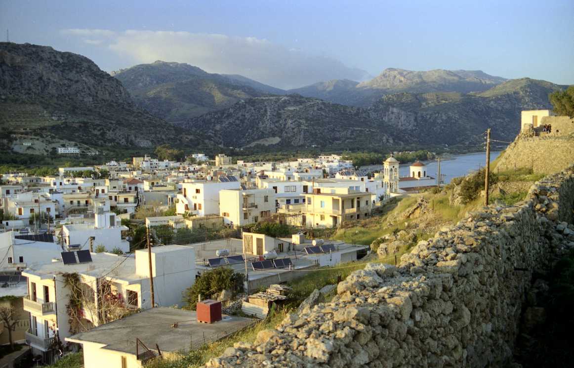
- Palaiochora
Infobox Greek Dimos
name = Palaiochora
name_local = Παλαιόχωρα
periph =Crete
prefec = Chania
population = 2213
population_as_of = 2001
area =
elevation_min = 1
elevation_max = 20
lat_deg = 35
lat_min = 15
lon_deg = 23
lon_min = 45
postal_code = 730 00
area_code = 28230
licence = ΧΝ
mayor = George Dermitzakis
since =
party =
districts = Municipality of Pelekanos
metro_pop =
area_metro =
website =
caption_skyline = Photograph of Palaiochora
city_
city_Palaiochora ( _el. Παλαιόχωρα or Παλιόχωρα) is a small town in
Chania prefecture . Paleochora is located 77 km south ofChania , at the southwest coastline ofCrete and it’s built on a small peninsula of 400m width and 700m length. The town is set along 11 km of coastline bordering theLibyan Sea . It is the capital town of the municipality ofPelekanos , in the province ofSelino and its population was 2213 in the 2001 census. [ [http://www.statistics.gr/gr_tables/S1101_SAP_1_TB_DC_01_03_Y.pdf "Census pages for Paleochora, from the 2001 Greek Census"] ,PDF (875 KB, in "Greek"),National Statistical Service of Greece (ΕΣΥΕ), 2001]Economy
Palaiochora’s economy is based in tourism and in agriculture (mainly
tomatoe s cultivated in glass-houses and also the production ofolive oil ). It is a relaxing holiday place since early 70’s, when it was a popularHippy destination. Currently, Paleochora is currently one of the fastest growing tourist towns on Crete.Paleochora has crystal clear waters, well-organized beaches and beautiful isolated little anchorages. It is served by numerous hotels, restaurants, taverns, cafes, bars and nightclubs. Facilities in Paleochora include bank branches, a
post office , a central telephone office, health centre, doctor's offices, dentists, pharmacies, police station, coast guard and customs office and many types of stores. Ferry boats connecting Paleochora withSougia ,Agia Roumeli , Loutro,Chora Sfakion andGavdos dock in Paleochora.Paleochora is built on the ruins of the ancient city of
Kalamydi . There are also many Byzantine churches in the area.History
In 1278, the Venetian general Marinos Gradengos built a fort in the Palechora area, called the "Selino Kasteli". The fort gave its name to the whole province, previously called "Orina", which was then renamed "Selino". The fort was destroyed in 1332 and it was rebuilt in 1334. Near the fort, the Venetians established a new settlement for workers and merchants called Vourgos. The pirate
Hayreddin Barbarossa destroyed the fort in 1539, but later in 1595 Dolf revamped it. In 1645, the Turks conquered the town and modified the fort to suit their needs.In 1834 an English traveler named
Robert Pashley found the fort completely destroyed and the whole area without any inhabitants and with only a granary and one or two small buildings left. In 1866 the recolonization of Paleochora began.During the
Battle of Crete duringWorld War II , the town was the scene of fighting between motorcycle-riding troops of the German 95th Reconnaissance Battalion and the Eighth Greek Regiment (Provisional) with elements of the Cretan Gendarmerie.The general phase of
urbanization that started in other parts of Greece in the 1960s, took place in the 1950s on the nearby island ofGavdos . During that period the islanders exchanged their land on Gavdos for ex-Turkish land on Crete, which had now become exchangeable through a state program. They created a community known as "Gavdiotika", in the 'old town' section of Paleochora.References
Wikimedia Foundation. 2010.
