- Pennsylvania Route 346
-
PA Route 346
Route information Maintained by PennDOT Length: 34 mi[2] (55 km) Existed: 1928[1] – present Major junctions West end:  NY 280 at the New York state line in the Allegheny National Forest
 PA 321 in the Allegheny National Forest

 US 219 / PA 46 in Bradford
East end:  PA 446 in Eldred
Location Counties: Warren, McKean Highway system Roads in Pennsylvania
Interstate • US • State • Legislative←  PA 345
PA 347  →
→←  PA 158
PA 160  →
→Pennsylvania Route 346 (designated by the Pennsylvania Department of Transportation as SR 0346) is a 34-mile (55 km) state highway located in Warren and McKean counties in Pennsylvania, United States The western terminus is at the New York state line in the Allegheny National Forest, where it becomes New York State Route 280. The eastern terminus is at an intersection with PA 446 in Eldred.
Contents
Route description
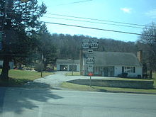 Intersection of PA 346 and PA 646 in Derrick City, outside of Bradford
History
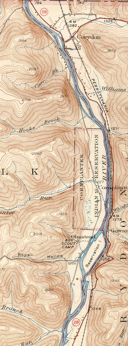
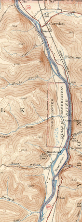 The routing of PA 159 along the Allegheny River in 1941
PA 346 was assigned in the original assignment of state highways in Pennsylvania. It originally began in Foster Brook, north of Bradford, and ended in Eldred.[1] It was extended westward in 1935 to a new terminus at Corydon, where it ended at PA 159,[3] a north–south route assigned in 1928 that began at PA 59 in Cornplanter and followed the Allegheny River north to the New York state line.[1] This 10-mile (16 km) alignment of PA 159 remained in place until 1946, when all of PA 159 south of Corydon was replaced by an extended PA 346. The short segment of PA 159 between Corydon and the state line became unnumbered.[4]
When the Allegheny Reservoir was completed in 1967, the portion of PA 346 near the Allegheny River was permanently inundated. As a result, PA 346 was rerouted slightly on its existing western end to head northwest to the state line, where it connected to the rebuilt New York State Route 280.[5][6] Originally, PA 346 followed East Main Street in Bradford and Foster Brook.[7] When the Bradford Bypass (US 219) was finished in 1977, the Pennsylvania Department of Transportation realigned PA 346 onto the bypass as well.[8]
Major intersections
County Location Mile Destinations Notes Warren New York state line NY 280Western terminus of PA 346, continues as NY 280 McKean Allegheny National Forest PA 321Northern terminus of PA 321 Bradford US 219 southInterchange, West end of US 219 concurrency PA 46 (Kendall Avenue)Interchange, northern terminus of PA 46 Foster Brook US 219 northInterchange, East end of US 219 concurrency Derrick City  PA 646 north (Olean Road)
West end of PA 646 concurrency Summit PA 646 south (Old Plank Road)East end of PA 646 concurrency Duke Center  PA 546
Southern terminus of PA 546 Prentisvale  PA 246 (Looker Mountain Trail)
Eastern terminus of PA 246 Eldred PA 446Eastern terminus of PA 346 1.000 mi = 1.609 km; 1.000 km = 0.621 mi See also
References
- ^ a b c Pennsylvania Department of Highways (1928). Map Showing Pennsylvania State Highways (Map).
- ^ Pennsylvania Highways - Pennsylvania Route 346
- ^ Pennsylvania Department of Recreation (1935). Pennsylvania Highways and Parks Map (Map).
- ^ Pennsylvania Department of Highways (1946). Pennsylvania Official Road Map (Map).
- ^ Pennsylvania Department of Highways (1960). Official Map of Pennsylvania (Map). ftp://ftp.dot.state.pa.us/public/pdf/BPR_pdf_files/Maps/Statewide/Historic_OTMs/1960fr.pdf. Retrieved June 14, 2009.
- ^ Pennsylvania Department of Highways (1970). Official Map of Pennsylvania (Map). ftp://ftp.dot.state.pa.us/public/pdf/BPR_pdf_files/Maps/Statewide/Historic_OTMs/1970fr.pdf. Retrieved June 14, 2009.
- ^ Pennsylvania Department of Transportation (1976). Discover The New Pennsylvania (Map).
- ^ Pennsylvania Department of Transportation (1977). Pennsylvania (Map).
Categories:- State highways in Pennsylvania

Wikimedia Foundation. 2010.