- Flowery Branch, Georgia
Infobox Settlement
official_name = Flowery Branch, Georgia
other_name =
native_name =
nickname =
settlement_type =Town
motto =
imagesize =
image_caption =
flag_size =
image_
seal_size =
image_shield =
shield_size =
image_blank_emblem =
blank_emblem_type =
blank_emblem_size =
imagesize =
image_caption =
flag_size =
image_
seal_size =
image_shield =
shield_size =
image_blank_emblem =
blank_emblem_type =
blank_emblem_size =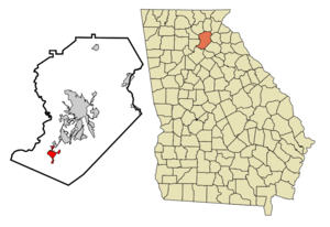
mapsize = 250px
map_caption = Location in Hall County and the state of Georgia
mapsize1 =
map_caption1 =
image_dot_
dot_mapsize =
dot_map_caption =
dot_x =
dot_y =
pushpin_
pushpin_label_position =
pushpin_map_caption =
pushpin_mapsize =
subdivision_type = Country
subdivision_name =United States
subdivision_type1 = State
subdivision_name1 = Georgia
subdivision_type2 = County
subdivision_name2 = Hall
subdivision_type3 =
subdivision_name3 =
subdivision_type4 =
subdivision_name4 =
government_footnotes =
government_type =
leader_title =
leader_name =
leader_title1 =
leader_name1 =
leader_title2 =
leader_name2 =
leader_title3 =
leader_name3 =
leader_title4 =
leader_name4 =
established_title =
established_date =
established_title2 =
established_date2 =
established_title3 =
established_date3 =
area_magnitude =
unit_pref = Imperial
area_footnotes =
area_total_km2 = 6.4
area_land_km2 = 6.4
area_water_km2 = 0
area_total_sq_mi = 2.5
area_land_sq_mi = 2.5
area_water_sq_mi = 0
area_water_percent =
area_urban_km2 =
area_urban_sq_mi =
area_metro_km2 =
area_metro_sq_mi =
area_blank1_title =
area_blank1_km2 =
area_blank1_sq_mi =
population_as_of = 2000
population_footnotes =
population_note =
population_total = 1806
population_density_km2 = 282.2
population_density_sq_mi = 722.4
population_metro =
population_density_metro_km2 =
population_density_metro_sq_mi =
population_urban =
population_density_urban_km2 =
population_density_urban_sq_mi =
population_blank1_title =
population_blank1 =
population_density_blank1_km2 =
population_density_blank1_sq_mi =
timezone = Eastern (EST)
utc_offset = -5
timezone_DST = EDT
utc_offset_DST = -4
latd = 34 |latm = 11 |lats = 9 |latNS = N
longd = 83 |longm = 55 |longs = 28 |longEW = W
elevation_footnotes =
elevation_m = 342
elevation_ft = 1122
postal_code_type =ZIP code
postal_code = 30542
area_code = 770
blank_name = FIPS code
blank_info = 13-30340GR|2
blank1_name = GNIS feature ID
blank1_info = 0331733GR|3
website =
footnotes =Flowery Branch is a town in Hall County, Georgia,
United States . The population was 1,806 at the 2000 census. In 2005 census the population reached up to 4,500.Geography
Flowery Branch is located at coor dms|34|11|9|N|83|55|28|W|city (34.185801, -83.924479)GR|1.
According to the
United States Census Bureau , the town has a total area of 2.5square mile s (6.5km² ), of which, 2.5 square miles (6.4 km²) of it is land and 0.40% is water.Flowery Branch borders Chestnut Mountain, Gainesville, and Braselton.
Town Facts
Flowery Branch was originally named Anaguluskee, a Cherokee Indian word meaning "flowers on the branch." [http://www.gainesvilletimes.com/communities/towns/flowerybranch.shtml]
The
NFL team theAtlanta Falcons training camp has been located in Flowery Branch since the beginning of the 2001 season. [ [http://www.flowerybranchga.org/falcons_campus.html City of Flowery Branch » Falcons Campus ] ]Flowery Branch is listed as the home town of
Johnny O'Connell , a team driver of thePratt & Miller Corvette team in international sports car racing.Demographics
As of the
census GR|2 of 2000, there were 1,806 people, 706 households, and 475 families residing in the town. Thepopulation density was 725.3 people per square mile (280.0/km²). There were 820 housing units at an average density of 329.3/sq mi (127.2/km²). The racial makeup of the town was 80.22% White, 10.18% African American, 0.44% Native American, 0.28% Asian, 2.21% from other races, and 0.66% from two or more races. Hispanic or Latino of any race were 9.69% of the population.There were 706 households out of which 33.3% had children under the age of 18 living with them, 43.6% were married couples living together, 17.0% had a female householder with no husband present, and 32.6% were non-families. 23.8% of all households were made up of individuals and 7.1% had someone living alone who was 65 years of age or older. The average household size was 2.56 and the average family size was 3.01.
In the town the population was spread out with 25.7% under the age of 18, 12.1% from 18 to 24, 35.4% from 25 to 44, 18.1% from 45 to 64, and 8.6% who were 65 years of age or older. The median age was 31 years. For every 100 females there were 103.4 males. For every 100 females age 18 and over, there were 96.3 males.
The median income for a household in the town was $35,478, and the median income for a family was $38,500. Males had a median income of $29,572 versus $21,382 for females. The
per capita income for the town was $16,970. About 9.5% of families and 13.3% of the population were below thepoverty line , including 13.1% of those under age 18 and 21.6% of those age 65 or over.References
External links
Wikimedia Foundation. 2010.