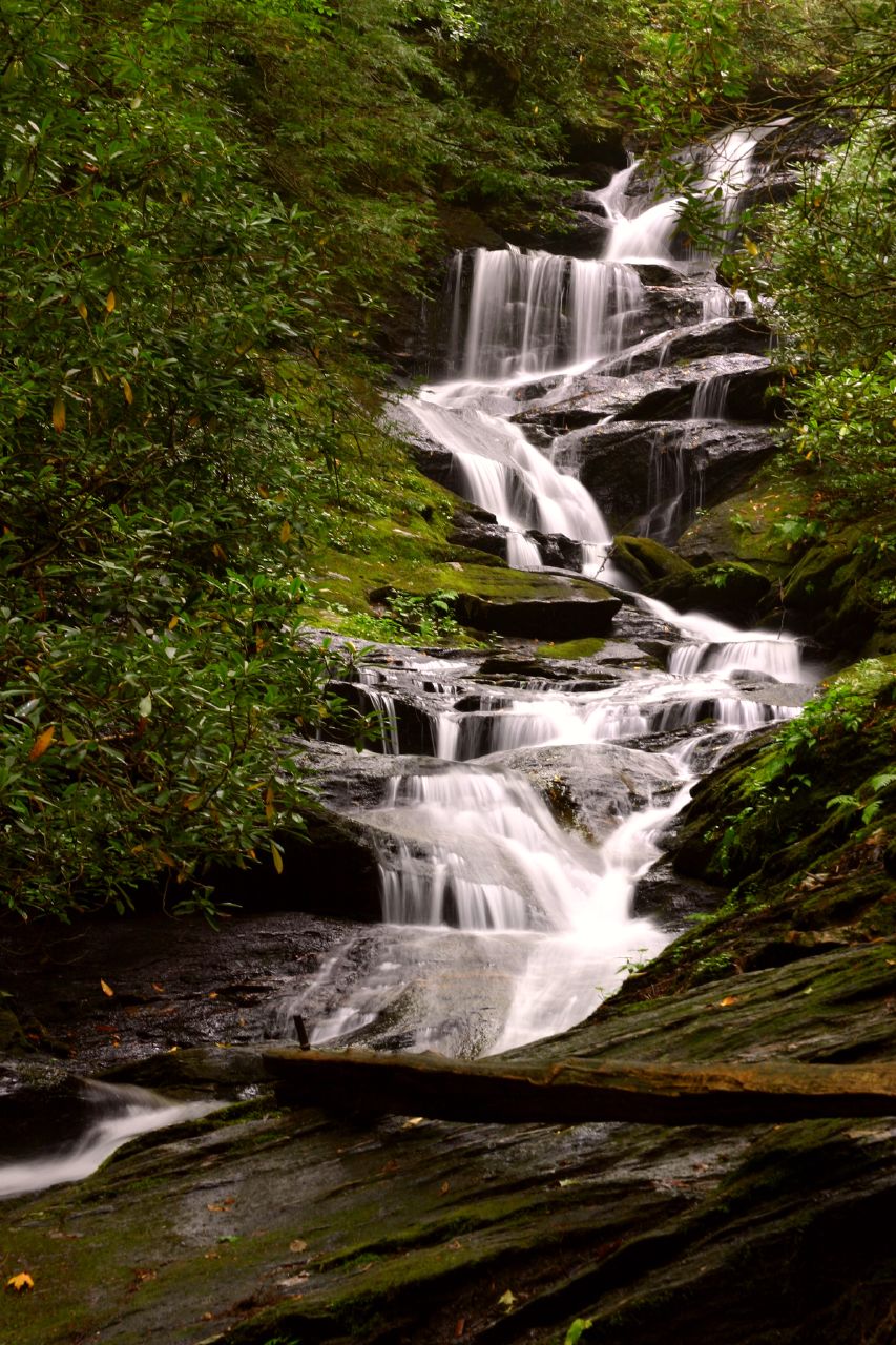
Roaring Fork Falls (Yancey County)
- Roaring Fork Falls (Yancey County)
Infobox Waterfall
caption=
name=Roaring Fork Falls
location=Pisgah National Forest, Yancey County, in the Blue Ridge Mountains of North Carolina
type=Cascade, Slide
height=Convert|45|ft|m|0nowrap| - disputed|abbr=on[Kevin Adams, "North Carolina Waterfalls", p. 143] ]
drop=
numberofdrops=
flow=
heightrank=
coordinates=coord|35.76033|-82.1917
Roaring Fork Falls, also called Roaring Creek Falls, is a waterfall in the Pisgah National Forest, in North Carolina.
Geology
The falls is located on Roaring Fork, a tributary of the South Toe River, which itself is a tributary of the French Broad River. The creek is located in a forest that's filled with rhododendron and eastern hemlock. The creek is abundant with freshwater snails.
Height
There are some disputes as to the height of the falls. Kevin Adams' book, North Carolina Waterfalls, lists the height as "about 45 ft (17 m) high". [http://www.ncwaterfalls.com North Carolina Waterfalls] lists the falls as being 100 feet (30.9 m) "long".
Visiting the Falls
From the intersection of NC 80 and the Blue Ridge Parkway, go 2.2 miles north on NC 80 and turn left on South Toe River Road. Cross the bridge and turn left. Follow the road 0.2 miles to the gate and parking area. From here, follow the trail (passing concrete bunkers formerly used to store explosives) for 0.61 mi. (1.34 km) to a side trail that will lead to the falls in 300 ft (93 m).
Nearby Falls
*Setrock Creek Falls
*Mitchell Falls
*Douglas Falls
*Walker Falls
*Whiteoak Creek Falls
*Crabtree Falls
References
[http://www.ncwaterfalls.com/setrock1.html Roaring Fork Falls on NCWaterfalls.com]
Wikimedia Foundation.
2010.
Look at other dictionaries:
Mitchell Falls — Mitchell s Falls, 1859 Location Blue Ridge Mountains, Yancey County, North Carolina Coordinates … Wikipedia
Setrock Creek Falls — Infobox Waterfall| caption= name=Setrock Creek Falls location=Pisgah National Forest, Yancey County, in the Blue Ridge Mountains of North Carolina type=Cascade, Slide height=Convert|55|ft|m|0nowrap| disputed|abbr=onKevin Adams, North Carolina… … Wikipedia
Whiteoak Creek Falls — Infobox Waterfall caption= name=Whiteoak Creek Falls location=Pisgah National Forest, Yancey County, in the Blue Ridge Mountains of North Carolina type=Cascade, Slide height=Convert|20|ft|m|0 drop= numberofdrops= flow= heightrank=… … Wikipedia
Wilkes County, North Carolina — Seal … Wikipedia
Waterfalls of North Carolina — The waterfalls of North Carolina, U.S.A., are a prominent feature of the geography of the piedmont and mountain regions of the state, as well as a major focus of tourism and outdoor recreation. Many of these falls are located in state parks,… … Wikipedia
List of waterfalls — This is a list of waterfalls of the world by continent.AfricaAngola*Kalandula Falls, second largest in AfricaBurkina Faso*Tagbaladougou FallsDemocratic Republic of the Congo*Boyoma Falls (Stanley Falls) *Inga Falls *Livingstone Falls *Lofoi… … Wikipedia
Masonic Lodges of North Carolina — Part of a series of articles on Freemasonry Core Articles Freemasonry · Grand Lodge · Masonic Lodge · Masonic Lodge Officers · Grand Master · Prince Hall Freemasonry · Regular Masonic jurisdictions · Continental F … Wikipedia
List of townships in North Carolina — The U.S. state of North Carolina is divided into 1,035 townships in 100 counties.[1] Township County 2010 Census Abbotts Township Bladen 1,094 Abbotts Creek Township Davidson 12,846 Abbotts Creek Township Fors … Wikipedia