- Atolinga (municipality)
Infobox Settlement
official_name = Municipality of Atolinga
other_name =
native_name =
nickname =
settlement_type = Municipality
motto =
imagesize =
image_caption =
flag_size =
image_
seal_size =
image_shield =
shield_size =
city_logo =
citylogo_size =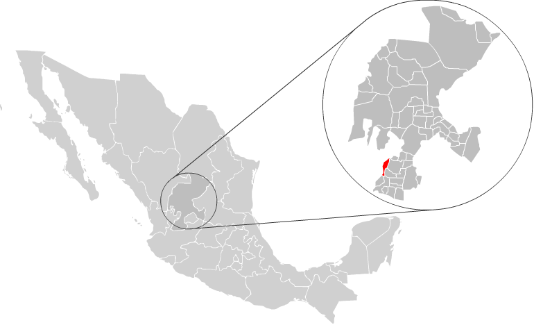
mapsize =
map_caption = Location of Atolinga with inZacatecas and Mexico
mapsize1 =
map_caption1 =
image_dot_
dot_mapsize =
dot_map_caption =
dot_x = |dot_y =
pushpin_
pushpin_label_position =
pushpin_map_caption =
pushpin_mapsize =
subdivision_type = Country
subdivision_name = MEX
subdivision_type1 = State
subdivision_name1 =Zacatecas
subdivision_type2 = Municipal seat
subdivision_name2 = Atolinga
subdivision_type3 = Largest city
subdivision_name3 =Atolinga
subdivision_type4 =
subdivision_name4 =
government_footnotes =
government_type =
leader_title = Municipal President
leader_name = Rodolfo Castro López, PAN
leader_title1 =
leader_name1 =
leader_title2 =
leader_name2 =
leader_title3 =
leader_name3 =
leader_title4 =
leader_name4 =
established_title =
established_date =
established_title2 = Municipality
established_date2 = 1917
established_title3 =
established_date3 =
area_magnitude =
unit_pref =
area_footnotes =
area_total_km2 = 280
area_land_km2 =
area_water_km2 =
area_total_sq_mi =
area_land_sq_mi =
area_water_sq_mi =
area_water_percent =
area_urban_km2 =
area_urban_sq_mi =
area_metro_km2 =
area_metro_sq_mi =
area_blank1_title =
area_blank1_km2 =
area_blank1_sq_mi =
population_as_of = 2005
population_footnotes =
population_note =
population_total = 2738
population_density_km2 =
population_density_sq_mi =
population_metro =
population_density_metro_km2 =
population_density_metro_sq_mi =
population_urban =
population_density_urban_km2 =
population_density_urban_sq_mi =
population_blank1_title = Largest city
population_blank1 = 1465Atolinga
population_density_blank1_km2 =
population_density_blank1_sq_mi =
timezone = CST
utc_offset = -6
timezone_DST =
utc_offset_DST =
latd=21 |latm=44 |lats=15 |latNS=N
longd=103 |longm=28 |longs=30 |longEW=W
elevation_footnotes =
elevation_m = 2250
elevation_ft =
postal_code_type = Postal Code
postal_code = 99730
area_code = 437
blank_name =
blank_info =
blank1_name =
blank1_info =
website =
footnotes =Atolinga is one of the 58 municipalities in the state of
Zacatecas ,Mexico . It is located on the southern part of the state of Zacatecas and is bordered by the municipalities of Tepechitlán andFlorencia de Benito Juárez . To the east it is bordered byTlaltenango de Sánchez Román and to the north and west by the state ofJalisco .The municipality covers a total surface area of km2 to sq mi|280 [ [http://www.e-local.gob.mx/work/templates/enciclo/zacatecas/municipios/32003a.htm "Atolingo", Encyclopedia de Municipios ] ] .History
Prior to the arrival of the Spanish to the area, the region around Atolinga was inhabited by indigenous people of the
Caxcan and Tepecan ethnic groups. The first Spanish contact with these people must have been in 1530 whenPedro Almíndez Chirino went through the Valley ofTlaltenango on a northbound expedition.The first land grantee of the area was Pedro Sernosa, who later sold his land to Juan Fernández de Jara Quemada.
The town formed part of the jurisdiccion of Tlaltenango for both ecclesiastical purposes and governmental purposes until the beginning of the 1800s. In 1814, a plea was made by the citizenry that the community be granted its own town council and status as a municipality due to the long distance from the municipal seat and the ascending local population. The plea spells out that the town counted with nearly 700 "souls" and that within a radius of two leagues lived more than 3,700 people.
Population
In the 2005 census Atolinga, reported a population of 2,738. [http://www.inegi.gob.mx/est/contenidos/espanol/sistemas/conteo2005/localidad/iter/ Link to tables of population data from Census of 2005] INEGI: Instituto Nacional de Estadística, Geografía e Informática] Of these, 1,453 lived in the municipal seat and the remainder lived in surrounding rural communities.
References
Wikimedia Foundation. 2010.