- Cocos Lagoon
-
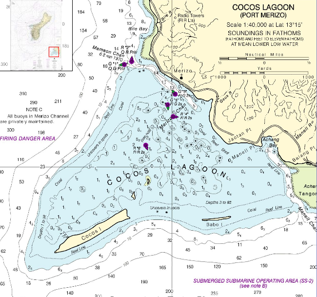
 NOAA nautical chart of Cocos Lagoon
Cocos Lagoon appears as a small incomplete coral atoll attached to the southwestern coast of Guam in the area of the village of Merizo. It stretches about 5.5 km east-west and 3.5 km north-south, covering an area of more than 10 km².
Cocos Island and Babe Island sit atop the southern portion of the Merizo Barrier Reef and separate Cocos Lagoon from the open ocean in the south. In the east, Cocos Lagoon is separated from Achang Reef by narrow Manell Channel that leads to Achang Bay. In the northwest, Mamaon Channel separates Cocos Lagoon from the main island of Guam and allows boat access to Merizo. Southeastward of the channel, down to Achang Bay, there is no separation to the main island of Guam. Along the west side, the barrier reef uncovers in spots but has no islands.
References
- Bendure, G. & Friary, N. (1988) Micronesia:A travel survival kit. South Yarra, VIC: Lonely Planet.
Coordinates: 13°15′07″N 144°39′43″E / 13.252°N 144.662°E
Categories:- Geography of Guam
- Guam geography stubs
Wikimedia Foundation. 2010.