- Mount Hampton
-
Mount Hampton 
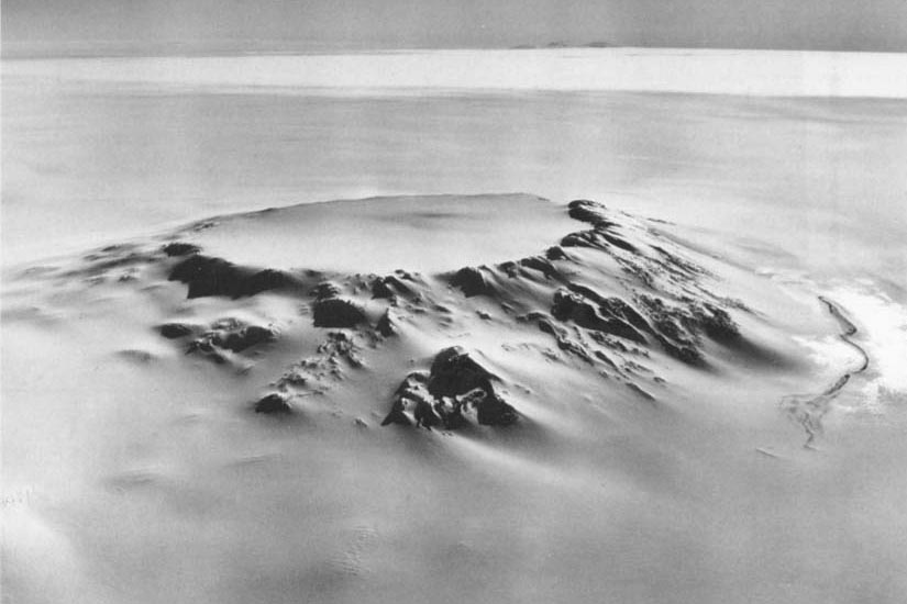
The caldera of Mt. Hampton viewed from the northwest.Elevation 3,323 m (10,902 ft) Location Location Marie Byrd Land, Antarctica Range Executive Committee Range Coordinates 76°29′S 125°48′W / 76.483°S 125.8°WCoordinates: 76°29′S 125°48′W / 76.483°S 125.8°W Geology Type Shield volcano (extinct) Mount Hampton is a shield volcano with a circular ice-filled crater occupying much of the summit area. It is the northernmost of the extinct volcanoes which comprise the Executive Committee Range in Marie Byrd Land.
Discovered by the USAS on a flight, December 15, 1940, and named for Ruth Hampton, Dept. of the Interior member of the USAS Executive Committee. Mapped in detail by USGS from surveys and U.S. Navy trimetrogon photography, 1958-60.
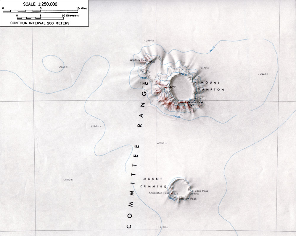
 Topographic map of Mount Hampton (1:250,000 scale) from USGS Mount Hampton
See also
Sources
- LeMasurier, W. E.; Thomson, J. W. (eds.) (1990). Volcanoes of the Antarctic Plate and Southern Oceans. American Geophysical Union. p. 512 pp. ISBN 0-87590-172-7.
- U.S. Geological Survey Geographic Names Information System: Mount Hampton
- "Amar Andalkar's Ski Mountaineering and Climbing Site. Skiing the Pacific Ring of Fire and Beyond". 1997–2007. http://www.skimountaineer.com/ROF/RingOfFire.html. Retrieved 2005-01-14.

This Marie Byrd Land location article is a stub. You can help Wikipedia by expanding it.