- Müglitztal
-
Müglitztal 

 MüglitztalLocation of Müglitztal within Sächsische Schweiz-Osterzgebirge district
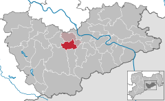

Coordinates 50°55′N 13°49′E / 50.91667°N 13.81667°ECoordinates: 50°55′N 13°49′E / 50.91667°N 13.81667°E Administration Country Germany State Saxony Admin. region Dresden District Sächsische Schweiz-Osterzgebirge Municipal assoc. Dohna-Müglitztal Local subdivisions 7 Mayor Jörg Glöckner Basic statistics Area 21.00 km2 (8.11 sq mi) Elevation 150-450 m Population 2,062 (31 December 2010)[1] - Density 98 /km2 (254 /sq mi) Other information Time zone CET/CEST (UTC+1/+2) Licence plate PIR Postal code 01809 Area code 035027 Website www.oberelbe.de Müglitztal is a municipality in the Sächsische Schweiz-Osterzgebirge district, in Saxony, Germany.
References
- ^ "Bevölkerung des Freistaates Sachsen jeweils am Monatsende ausgewählter Berichtsmonate nach Gemeinden" (in German). Statistisches Landesamt des Freistaates Sachsen. 31 December 2010. http://www.statistik.sachsen.de/download/010_GB-Bev/Bev_Gemeinde.pdf.
Altenberg | Bad Gottleuba-Berggießhübel | Bad Schandau | Bahretal | Bannewitz | Dippoldiswalde | Dohma | Dohna | Dorfhain | Dürrröhrsdorf-Dittersbach | Freital | Glashütte | Gohrisch | Hartmannsdorf-Reichenau | Heidenau | Hermsdorf | Höckendorf | Hohnstein | Kirnitzschtal | Königstein | Kreischa | Liebstadt | Lohmen | Müglitztal | Neustadt in Sachsen | Pirna | Porschdorf | Pretzschendorf | Rabenau | Rathen | Rathmannsdorf | Reinhardtsdorf-Schöna | Rosenthal-Bielatal | Schmiedeberg | Sebnitz | Stadt Wehlen | Stolpen | Struppen | Tharandt | Wilsdruff Categories:
- Municipalities in Saxony
- Saxony geography stubs


Wikimedia Foundation. 2010.