- Ballycanew
Infobox Irish Place
name = "Ballycanew"
gaeilge = Baile Uí Chonnmhaí
crest
motto =
map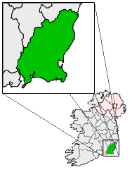
pin coords = left: 88px; top: 35px
north coord = 52.609 | west coord = 6.31 | irish grid = T146524
area =
elevation = 60 m (196 ft)
province =Leinster
county =County Wexford
town pop = Much Lower than 464 | rural pop = 464
census yr = 2006
web =
|Ballycanew ("Baile Uí Chonnmhaí" in Irish) is a small rural village in Ireland. It is situated in
County Wexford , on the R741regional road km to mi | 8 | abbr=yes | precision=0 south ofGorey . It has two churches- one Roman Catholic and another Church of Ireland. The village has two shops: aGala and aLondis .The Ounavarra river which passes through the village, this has a great reputation for fishing. This picturesque village was once known as Ballyconway. An old Irish name for Ballycanew is 'Baile Gan Uaigh' - Town without a grave.
The earliest reference is 1247 when Theodore de Nevel held lands there. In 1821, the population was 1094, but following the great famine it was reduced to 361.
In the past the Furney family owned a mill, built in in 1589 and demolished in 1962. The old creamery was once a thriving industry, with an average of 2.5 million gallons of milk supplied per annum. 'Papa Rhodes' restaurant is now situated in the old creamery.
In June 1965, a Bronze Age grave was discovered in the Ballycanew Parish. There was a food vessel slightly damaged and broken human bones. The exact date of the burial is uncertain, but is probably more than 3,000 years old.
ee also
*
List of towns in the Republic of Ireland
Wikimedia Foundation. 2010.