- Ward, Arkansas
Infobox Settlement
official_name = Ward, Arkansas
settlement_type =City
imagesize =
image_caption =
image_
imagesize =
image_caption =
image_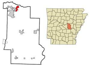
mapsize = 250x200px
map_caption = Location in Lonoke County and the state ofArkansas
mapsize1 =
map_caption1 =
subdivision_type = Country
subdivision_type1 = State
subdivision_type2 = County
subdivision_name =United States
subdivision_name1 =Arkansas
subdivision_name2 = Lonoke
government_type = mayor-council
leader_title = Mayor
leader_name = Art Brooke
established_date =
area_magnitude =
area_total_km2 = 10.1
area_total_sq_mi = 3.9
area_land_km2 = 10.1
area_land_sq_mi = 3.9
area_water_km2 = 0
area_water_sq_mi = 0
elevation_ft = 243
elevation_m = 74
population_as_of = 2000
population_footnotes =
population_total = 2580
population_metro =
population_density_km2 = 255.4
population_density_sq_mi = 661.5
timezone = Central (CST)
utc_offset = -6
latd = 35 |latm = 1 |lats = 12 |latNS = N
longd = 91 |longm = 57 |longs = 18 |longEW = W
timezone_DST = CDT
utc_offset_DST = -5
postal_code_type =ZIP code
postal_code = 72176
area_code = 501
blank_name = FIPS code
blank_info = 05-73130
blank1_name = GNIS feature ID
blank1_info = 0056036
footnotes =
website = [http://www.bestofward.com Ward city website]Ward is the fourth most populous city in Lonoke County,
Arkansas ,United States . The population was 2,580 at the 2000 census. It is part of the Little Rock–North Little Rock–Conway Metropolitan Statistical Area.Geography
Ward is located at coor dms|35|1|12|N|91|57|18|W|city (35.019996, -91.954987)GR|1.
According to the
United States Census Bureau , the city has a total area of 3.9square mile s (10.1km² ), all of it land.The city is divided into three wards, progressing from the northeast to the southwest. In the city's first ward is its downtown, which is situated diagonally along a railroad line running parallel to
Arkansas Highway 367 (the former path of U.S. Highway 67). The second ward contains the central portion of the city, its industrial area, and its access to the current U.S. Highway 67/167.Arkansas Highway 319 (Peyton Street within the city south of Highway 367) is a primary thoroughfare in central Ward toward the southwestern section of the city. Some of the most recent development is in the city's third ward, situated mostly along Peyton Street, south of Wilson Street into the Old Austin community andArkansas Highway 38 ; a small detached portion of the ward is located to the northwest along the railroad line and Arkansas Highway 367. Ward Central Elementary, the city's campus of the Cabot School District, is located in the larger portion of the third ward.Government
Ward is governed by a mayor-council form of municipal government, with a mayor, city clerk, and six-member city council, as well as four city departments — fire, police, street maintenance, and utilities (water and sanitation). City administration is housed in the former Ward Elementary School; the campus is also the site of the city's library, a branch of the Lonoke-Prairie Regional Library System.
Demographics
As of the
census GR|2 of 2000, there were 2,580 people, 938 households, and 726 families residing in the city. Thepopulation density was 662.4 people per square mile (256.1/km²). There were 1,075 housing units at an average density of 276.0/sq mi (106.7/km²). The racial makeup of the city was 97.33% White, 0.19% Black or African American, 0.78% Native American, 0.39% Asian, 0.16% from other races, and 1.16% from two or more races. 1.94% of the population were Hispanic or Latino of any race.There were 938 households out of which 46.7% had children under the age of 18 living with them, 60.3% were married couples living together, 12.4% had a female householder with no husband present, and 22.6% were non-families. 18.1% of all households were made up of individuals and 5.1% had someone living alone who was 65 years of age or older. The average household size was 2.75 and the average family size was 3.13.
In the city the population was spread out with 32.9% under the age of 18, 9.1% from 18 to 24, 33.3% from 25 to 44, 16.9% from 45 to 64, and 7.7% who were 65 years of age or older. The median age was 29 years. For every 100 females there were 95.6 males. For every 100 females age 18 and over, there were 91.4 males.
The median income for a household in the city was $32,924, and the median income for a family was $34,702. Males had a median income of $30,275 versus $21,151 for females. The
per capita income for the city was $13,581. About 13.6% of families and 16.5% of the population were below thepoverty line , including 18.8% of those under age 18 and 18.0% of those age 65 or over.References
External links
* [http://www.bestofward.com/home.html City of Ward Home page]
Wikimedia Foundation. 2010.