- Mazon Township, Grundy County, Illinois
-
Mazon Township — Township — Location in Grundy County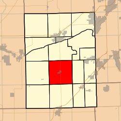 Grundy County's location in Illinois
Coordinates: 41°14′28″N 88°25′04″W / 41.24111°N 88.41778°WCoordinates: 41°14′28″N 88°25′04″W / 41.24111°N 88.41778°W Country United States State Illinois County Grundy Established November 6, 1849 Area – Total 35.49 sq mi (91.92 km2) – Land 35.49 sq mi (91.92 km2) – Water 0 sq mi (0 km2) 0% Elevation 584 ft (178 m) Population (2000) – Total 1,377 – Density 38.8/sq mi (15/km2) Time zone CST (UTC-6) – Summer (DST) CDT (UTC-5) ZIP codes 60424, 60444, 60450, 60479 GNIS feature ID 0429346 Mazon Township is one of seventeen townships in Grundy County, Illinois, USA. As of the 2000 census, its population was 1,377[1].
Contents
Geography
According to the United States Census Bureau, Mazon Township covers an area of 35.49 square miles (91.9 km2).
Cities, towns, villages
Cemeteries
The township contains these four cemeteries: Brookside, Old Mazon, Ward and Wheeler.
Major highways
Airports and landing strips
- J B Fillman Airport
School districts
- Coal City Community Unit School District 1
Political districts
- Illinois' 11th congressional district
- State House District 75
- State Senate District 38
References
- "Mazon Township, Grundy County, Illinois". Geographic Names Information System, U.S. Geological Survey. http://geonames.usgs.gov/pls/gnispublic/f?p=gnispq:3:::NO::P3_FID:0429346. Retrieved 2010-01-17.
- United States Census Bureau 2007 TIGER/Line Shapefiles
- United States National Atlas
External links

Norman Township Wauponsee Township Goose Lake Township Vienna Township 
Maine Township  Mazon Township

Highland Township Goodfarm Township Garfield Township Municipalities and communities of Grundy County, Illinois Cities 
Villages Braceville | Carbon Hill | Channahon‡ | Coal City‡ | Diamond‡ | Dwight‡ | East Brooklyn | Gardner | Godley‡ | Kinsman | Mazon | Minooka‡ | Seneca‡ | South Wilmington | Verona
Townships Aux Sable | Braceville | Erienna | Felix | Garfield | Goodfarm | Goose Lake | Greenfield | Highland | Maine | Mazon | Morris | Nettle Creek | Norman | Saratoga | Vienna | Wauponsee
Unincorporated
communitiesAux Sable | Central City | Clarke City‡ | Divine | Gorman | Harrisonville | Langham | Mazonia | Nettle Creek | Paytonville | Sand Ridge | Saratoga | Stockdale | Wauponsee |
Footnotes ‡This populated place also has portions in an adjacent county or counties
Categories:- Townships in Grundy County, Illinois


Wikimedia Foundation. 2010.