- Sparkman, Arkansas
Infobox Settlement
official_name = Sparkman, Arkansas
settlement_type =City
imagesize =
image_caption =
image_
imagesize =
image_caption =
image_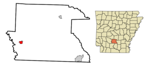
mapsize = 250px
map_caption = Location in Dallas County and the state ofArkansas
mapsize1 =
map_caption1 =
subdivision_type = Country
subdivision_type1 = State
subdivision_type2 = County
subdivision_name =United States
subdivision_name1 =Arkansas
subdivision_name2 = Dallas
government_type =
leader_title =
leader_name =
established_date =
area_magnitude =
area_total_km2 = 3.4
area_total_sq_mi = 1.3
area_land_km2 = 3.4
area_land_sq_mi = 1.3
area_water_km2 = 0
area_water_sq_mi = 0
elevation_ft = 171
elevation_m = 52
population_as_of = 2000
population_footnotes =
population_total = 586
population_metro =
population_density_km2 = 172.4
population_density_sq_mi = 450.8
timezone = Central (CST)
utc_offset = -6
latd = 33 |latm = 55 |lats = 2 |latNS = N
longd = 92 |longm = 50 |longs = 56 |longEW = W
timezone_DST = CDT
utc_offset_DST = -5
postal_code_type =ZIP code
postal_code = 71763
area_code = 870
blank_name = FIPS code
blank_info = 05-65900
blank1_name = GNIS feature ID
blank1_info = 0058666
footnotes =
website =:"Sparkman" redirects here. For the
Mega Man enemy, seeRobot Master ."Sparkman is a city in Dallas County,
Arkansas ,United States . The population was 586 at the 2000 census.Geography
Sparkman is located at coor dms|33|55|2|N|92|50|56|W|city (33.917201, -92.848763)GR|1.
According to the
United States Census Bureau , the city has a total area of 1.3square mile s (3.4km² ), all of it land.Demographics
As of the
census GR|2 of 2000, there were 586 people, 237 households, and 167 families residing in the city. Thepopulation density was 451.4 people per square mile (174.0/km²). There were 291 housing units at an average density of 224.2/sq mi (86.4/km²). The racial makeup of the city was 50.85% White, 42.15% Black or African American, 0.34% Native American, 6.48% from other races, and 0.17% from two or more races. 6.83% of the population were Hispanic or Latino of any race.There were 237 households out of which 26.6% had children under the age of 18 living with them, 48.1% were married couples living together, 18.1% had a female householder with no husband present, and 29.5% were non-families. 27.0% of all households were made up of individuals and 11.8% had someone living alone who was 65 years of age or older. The average household size was 2.47 and the average family size was 2.95.
In the city the population was spread out with 26.6% under the age of 18, 8.0% from 18 to 24, 23.5% from 25 to 44, 27.1% from 45 to 64, and 14.7% who were 65 years of age or older. The median age was 40 years. For every 100 females there were 86.6 males. For every 100 females age 18 and over, there were 82.2 males.
The median income for a household in the city was $25,208, and the median income for a family was $32,875. Males had a median income of $26,875 versus $20,795 for females. The
per capita income for the city was $12,492. About 14.0% of families and 21.9% of the population were below thepoverty line , including 28.4% of those under age 18 and 18.6% of those age 65 or over.Education
Sparkman has an elementary and high school with an enrollment of 230 pupils K-12. They are now part of the (Camden) Harmony Grove School District. Sparkman Schools have high standards of education and the high school has recently been given a seven out of ten rating on greatschools.com, which rates high schools based on academic success. This rating is higher than any other high school around them. Sparkman athletics teams are known as the Raiders. They compete at the 1a level in girls and boys basketball, baseball, and softball. Sparkman had a football team until they consolidated in 2004. They were very competitive for many years in which they played in many state playoff games, sometimes with only 16 players.
References
External links
Wikimedia Foundation. 2010.