- Montgomery Township, Crawford County, Illinois
-
Montgomery Township — Township — Location in Crawford County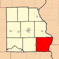 Crawford County's location in Illinois
Coordinates: 38°54′35″N 87°35′55″W / 38.90972°N 87.59861°WCoordinates: 38°54′35″N 87°35′55″W / 38.90972°N 87.59861°W Country United States State Illinois County Crawford Established June 21, 1869 Area - Total 54.5 sq mi (141.16 km2) - Land 54.05 sq mi (139.98 km2) - Water 0.45 sq mi (1.18 km2) 0.84% Elevation 558 ft (170 m) Population (2000) - Total 736 - Density 13.6/sq mi (5.3/km2) Time zone CST (UTC-6) - Summer (DST) CDT (UTC-5) ZIP codes 62427, 62451, 62454 GNIS feature ID 0429388 Montgomery Township is one of ten townships in Crawford County, Illinois, USA. As of the 2000 census, its population was 736[1].
Contents
Geography
According to the United States Census Bureau, Montgomery Township covers an area of 54.5 square miles (141 km2); of this, 0.45 square miles (1.2 km2) or 0.84 percent is water. The Wabash River defines its eastern border.
Cities, towns, villages
- Flat Rock (east quarter)
Unincorporated towns
- Crawfordsville
- Heathsville
- Morea
- Oil Grove
(This list is based on USGS data and may include former settlements.)
Cemeteries
The township contains these twenty-three cemeteries: Allen, Baker, Bartmess, Bennett, Dickerson, Ferrell, Ford, Fuller, Ganies, Green, Green Hill, Hale, Higgins, Johnson, Lackey, Maddox, Morea, Norton, Pleasant View, Seaney, Shaw, Tobey and Wesley Chapel.
Major highways
School districts
- Lawrence County Community Unit District 20
- Palestine Community Unit School District 3
- Robinson Community Unit School District 2
Political districts
- Illinois' 15th congressional district
- State House District 109
- State Senate District 55
References
- "Montgomery Township, Crawford County, Illinois". Geographic Names Information System, U.S. Geological Survey. http://geonames.usgs.gov/pls/gnispublic/f?p=gnispq:3:::NO::P3_FID:0429388. Retrieved 2010-01-10.
- United States Census Bureau 2007 TIGER/Line Shapefiles
- United States National Atlas
External links
Municipalities and communities of Crawford County, Illinois County seat: Robinson City 
Villages Flat Rock | Hutsonville | Oblong | Palestine | Stoy
Townships Honey Creek | Hutsonville | Lamotte | Licking | Martin | Montgomery | Oblong | Prairie | Robinson | Southwest
Unincorporated
communitiesAnnapolis | Bellair | Dogwood | Duncanville | Gordon | Green Brier | Hardinville | Heathsville | Kibbie | Landes | Morea | New Hebron | Oil Center | Oil Grove | Pierceburg | Port Jackson | Porterville | Richwoods | Riddleville‡ | Trimble | Villas | West York
Ghost town Footnotes ‡This populated place also has portions in an adjacent county or counties
Categories:- Townships in Crawford County, Illinois


Wikimedia Foundation. 2010.