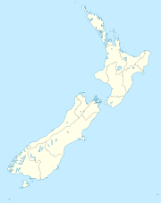
- Naenae
-
Naenae Basic information Local authority Lower Hutt City Population 8,292 (2006[1]) Facilities Train station(s) Naenae Railway Station Surrounds North Wingate Southwest Epuni West Boulcott Northwest Avalon Naenae (occasionally spelt NaeNae) is a suburb of the city of Lower Hutt in the North Island of New Zealand. It lies on the eastern edge of the floodplain of the Hutt River, four kilometres from the Lower Hutt Central business district. A small tributary of the Hutt, the Waiwhetu Stream, flows through the suburb.
Naenae has a population of around 8,000 people. It has several schools, including Naenae College (previously the second largest in Lower Hutt), Naenae Intermediate, Naenae Primary, Rata Street School, St. Bernadettes' and Wa Ora Montessori.
Naenae's shopping centre contains an Olympic-size swimming-pool, built when New Zealand hosted an international diving championships. The pool has three diving boards. Originally open-air, the complex gained a roof due to overwhelming public support, making it accessible all year round. A hydroslide adjacent to the main pool attracts more people. The toddlers' paddling pool remained open-air for a few years more.
Naenae or nae-nae is a translation from the Māori, meaning "mosquito" or "sandfly", recalling a time prior to the draining of the area, when the mosquito population predominated.
History
As Lower Hutt expanded after the end of World War II in 1945, the Labour government under Peter Fraser selected Naenae as an ideal site to become a "designer community", a model suburb of sorts, where a suburban state housing estate would complement a substantial shopping centre. This community centre would serve as a social hub for the greater area. The planners hoped that nuclear family life could manifest itself in such a scheme. Due to the increasing urbanisation of New Zealand, demand for housing outstripped the need f or such centres, leaving the scheme only partially realised.
Ernst Plischke, an Austrian architect, designed plans for the new community centre between 1942 and 1943. However the design was later drastically changed by government architect Gordon Wilson.[2][3]
Naenae railway station (opened 1946), on the Hutt Valley section of the Wairarapa Line, adjoins Naenae's shopping centre.
Naenae's post-modern Post Office officially opened in 1966, paying homage to the Art Deco era Main Post Office in Lower Hutt town centre.
A re-zoning of Naenae made it partly industrial in the 1960s, but it was principally a residential area. At its peak, Naenae boasted two manufacturers with strong Dutch connections:
- Philips, which produced televisions and radios, see pictures here. This industry closed down during the 1980s: Resene Paints now[update] occupies the buildings.
- Rembrandt Suits Ltd, formed following the Second World War by Dutch tailors. It now[update] exports mainly to Australia, and has major contracts throughout the world.
"Modern" Naenae
A recent article in the local Hutt News newspaper outlined some of the problems with the subway that connects Naenae centre to the railway station and Avalon. Many students of Naenae College and Naenae Intermediate use this subway to get to and from school. In recent times violent crimes and assaults have occurred within the subway, obliging the Principal of Naenae Intermediate to patrol the area. In 2009 security cameras were installed and a poorly-lit stairway was closed off.
Despite considerable investment and think-tanks on how to bolster the faltering local economy, Naenae has faced a steady decline since about 1980. In recent[update] times the demographics of the suburb have shifted significantly. Following the post-war baby-boom period, many of the parents of these children remained in Naenae, eventually progressing to pensioner status. As these people died, many migrants — predominately Pacific Islanders, but later including Somalis — replaced them. National economic difficulties have seen teenagers and young adults prone to violence and other criminal acts.
Naenae now[update] has a stagnant population. Statisticians predict minimal growth over the next decade[update], combined with an overall lower than average household income in comparison to the greater Wellington region.
According to the 2001 census, Naenae has approximately 7,150m2 retail floor-space, four times the economically viable amount sustainable by the local population. This retail space is mainly filled with takeaway shops and a pool, a library and some secondhand shops. There are also a supermarket and petrol station.
References
- ^ Hutt City Council - 2006 Hutt City Demographic Profile Retrieved: 7 January 2009
- ^ Bowman, Ian. "The challenge of change: dealing with the legacy of the modern movement". Translating the New Old-World into the New New-World - Reassessing Ernst Plischke's plan for for Naenae, Lower Hutt, New Zealand. http://books.google.co.nz/books?id=6EPdQnpvkb4C&pg=PT158&lpg=PT158&dq=ian+bowman+reassessing+ernst+plischke+naenae&source=bl&ots=IBLvAoJo2M&sig=juaYtktpI2SaVT2lI9Vzq9w1B7w&hl=en&ei=pixFTa_mH4K8sAOBpMSQCg&sa=X&oi=book_result&ct=result&resnum=1&ved=0CBUQ6AEwAA#v=onepage&q=ian%20bowman%20reassessing%20ernst%20plischke%20naenae&f=false. Retrieved 4/05/2011.
- ^ "The Importance of Being Ernst". New Zealand Historic Places Trust. http://www.historic.org.nz/en/Publications/HeritageNZMagazine/HeritageNz2004/HNZ04-ImportanceBeingErnst.aspx. Retrieved 4/05/2011.
Coordinates: 41°12′01″S 174°57′09″E / 41.2002°S 174.9525°E
Categories:- Suburbs of Lower Hutt
Wikimedia Foundation. 2010.

