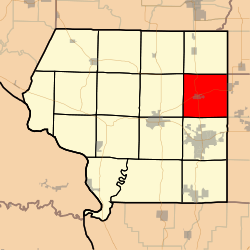
- DeSoto Township, Jackson County, Illinois
-
De Soto Township — Township — Location in Jackson County Jackson County's location in Illinois Coordinates: 37°49′07″N 89°12′50″W / 37.81861°N 89.21389°WCoordinates: 37°49′07″N 89°12′50″W / 37.81861°N 89.21389°W Country United States State Illinois County Jackson Established November 4, 1884 Area – Total 37.98 sq mi (98.38 km2) – Land 37.54 sq mi (97.22 km2) – Water 0.45 sq mi (1.16 km2) 1.18% Elevation 390 ft (119 m) Population (2000) – Total 2,231 – Density 59.4/sq mi (22.9/km2) Time zone CST (UTC-6) – Summer (DST) CDT (UTC-5) ZIP codes 62901, 62924, 62932, 62966 GNIS feature ID 0428892 De Soto Township is one of sixteen townships in Jackson County, Illinois, USA. As of the 2000 census, its population was 2,231[1].
Contents
Geography
According to the United States Census Bureau, De Soto Township covers an area of 37.98 square miles (98.4 km2); of this, 37.54 square miles (97.2 km2) (98.82 percent) is land and 0.45 square miles (1.2 km2) (1.18 percent) is water.
Cities, towns, villages
Unincorporated towns
- Reeds Station at 37°46′40″N 89°09′39″W / 37.7778282°N 89.160914°W
- Ward at 37°51′00″N 89°14′07″W / 37.8500506°N 89.2353614°W
(This list is based on USGS data and may include former settlements.)
Adjacent townships
- Elk Township (north)
- Six Mile Township, Franklin County (northeast)
- Carbondale Township (south)
- Murphysboro Township (southwest)
- Somerset Township (west)
- Vergennes Township (northwest)
Cemeteries
The township contains these five cemeteries: Beasley, Central-Crews, De Soto, Howard and Indian Hill.
Major highways
Airports and landing strips
- Southern Illinois Airport
School districts
- Elverado Community Unit School District 196
- Herrin Community Unit School District 4
Political districts
- Illinois' 12th congressional district
- State House District 115
- State Senate District 58
References
- "DeSoto Township, Jackson County, Illinois". Geographic Names Information System, U.S. Geological Survey. http://geonames.usgs.gov/pls/gnispublic/f?p=gnispq:3:::NO::P3_FID:0428892. Retrieved 2010-01-17.
- United States Census Bureau 2007 TIGER/Line Shapefiles
- United States National Atlas
External links
Municipalities and communities of Jackson County, Illinois Cities Ava | Carbondale | Grand Tower | Murphysboro
Villages Townships Bradley | Carbondale | Degognia | DeSoto | Elk | Fountain Bluff | Grand Tower | Kinkaid | Levan | Makanda | Murphysboro | Ora | Pomona | Sand Ridge | Somerset | Vergennes
Unincorporated
communitiesBoskydell | Cora | Crain | Degognia | Dry Hill | Etherton | Glenn | Grimsby | Hallidayboro | Harrison | Howardton | Jacob | Jones Ridge | Matthews Junction‡ | Mount Carbon | Neunert | Oraville | Pomona | Poplar Ridge | Raddle | Reeds Station | Sand Ridge | Sato | Stone Fort | Ward
Footnotes ‡This populated place also has portions in an adjacent county or counties
Categories:- Townships in Jackson County, Illinois
Wikimedia Foundation. 2010.


