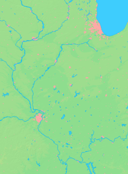
- De Soto, Illinois
-
De Soto Village Country United States State Illinois County Jackson Coordinates 37°48′56″N 89°13′41″W / 37.81556°N 89.22806°W Area 0.9 sq mi (2 km2) - land 0.9 sq mi (2 km2) Population 1,653 (2000) Density 1,752.4 / sq mi (677 / km2) Timezone CST (UTC-6) - summer (DST) CDT (UTC-5) Postal code 62924 Area code 618 Wikimedia Commons: De Soto, Illinois De Soto is a village in Jackson County, Illinois, United States. The population was 1,653 at the 2000 census.
De Soto was largely destroyed by the Great Tri-State Tornado of 1925. Sixty-nine people died in De Soto when approximately 30% of the town was destroyed, and of this total 33 were children at a local school that collapsed from the winds. The tornado affected Missouri, Illinois, and Indiana killing 695 and injuring over 2,000.
Contents
Geography
De Soto is located at 37°48′56″N 89°13′41″W / 37.815660°N 89.228184°W.[1]
According to the United States Census Bureau, the village has a total area of 0.9 square miles (2.3 km2), all of it land.
History
In 1787, the Congress of Confederation passed an ordinance which organized the territory of the United States northwest of the Ohio River. Settlers began to come to the Southern Illinois region from the areas of Kentucky, Virginia, and Pennsylvania. In 1818, Illinois became the 21st State in the Union.
When the Illinois Central Railroad came through this part of the state, the Village of DeSoto came into existence. The railroads considered the wood yard in DeSoto an important one before the trains began to burn coal. In 1854, the town was surveyed by Claiborn Barrow, surveyor for the county. The survey was requested by the owner of the land, David A. Neal of Salem, Massachusetts. The plat was certified to Mr. Barrow in November 1854 and recorded at the county seat in January 1855. (The name ADeSoto@ was derived from that of the Spanish explorer, Hernando DeSoto) S.S. Hall laid out the first addition to the Village. The post office was established in April of 1855, with Franklin Campbell as postmaster. By the 1880's, coal mining had become a profitable industry in the area. The town grew quickly over the years and has had many businesses; including a flour mill, sawmill, copper mill, newspaper, blacksmith shop, hotels, casket maker, saloons, gas stations, restaurants, and several drug and general merchandise stores.
Through the years, the Village of DeSoto has experienced several disasters. Shortly after the Civil War, a large portion of the Northern section of the town burned. In 1891, a fire did great damage to the southern portion of the town. Perhaps the most devastating to the people of DeSoto was the Great Tri-State Tornado of 1925. Much of the town was destroyed including the two story school building. The casualties of the tornado were numerous, including many children who were attending school at the time. Following each disaster, with a great sense of community, the people of DeSoto have bravely rebuilt their town.[1]
Demographics
As of the census[2] of 2000, there were 1,653 people, 673 households, and 444 families residing in the village. The population density was 1,752.4 people per square mile (679.0/km²). There were 726 housing units at an average density of 769.7 per square mile (298.2/km²). The racial makeup of the village was 97.58% White, 0.73% African American, 0.06% Native American, 0.42% Asian, 0.18% from other races, and 1.03% from two or more races. Hispanic or Latino of any race were 1.57% of the population.
There were 673 households out of which 33.9% had children under the age of 18 living with them, 51.4% were married couples living together, 11.3% had a female householder with no husband present, and 33.9% were non-families. 27.3% of all households were made up of individuals and 9.7% had someone living alone who was 65 years of age or older. The average household size was 2.45 and the average family size was 3.02.
In the village the population was spread out with 26.1% under the age of 18, 10.0% from 18 to 24, 33.3% from 25 to 44, 20.3% from 45 to 64, and 10.2% who were 65 years of age or older. The median age was 33 years. For every 100 females there were 94.5 males. For every 100 females age 18 and over, there were 90.5 males.
The median income for a household in the village was $31,563, and the median income for a family was $34,929. Males had a median income of $30,400 versus $22,632 for females. The per capita income for the village was $15,526. About 10.1% of families and 14.3% of the population were below the poverty line, including 19.7% of those under age 18 and 11.1% of those age 65 or over.
References
- ^ "US Gazetteer files: 2010, 2000, and 1990". United States Census Bureau. 2011-02-12. http://www.census.gov/geo/www/gazetteer/gazette.html. Retrieved 2011-04-23.
- ^ "American FactFinder". United States Census Bureau. http://factfinder.census.gov. Retrieved 2008-01-31.
Municipalities and communities of Jackson County, Illinois Cities Ava | Carbondale | Grand Tower | Murphysboro
Villages Townships Bradley | Carbondale | Degognia | DeSoto | Elk | Fountain Bluff | Grand Tower | Kinkaid | Levan | Makanda | Murphysboro | Ora | Pomona | Sand Ridge | Somerset | Vergennes
Unincorporated
communitiesBoskydell | Cora | Crain | Degognia | Dry Hill | Etherton | Glenn | Grimsby | Hallidayboro | Harrison | Howardton | Jacob | Jones Ridge | Matthews Junction‡ | Mount Carbon | Neunert | Oraville | Pomona | Poplar Ridge | Raddle | Reeds Station | Sand Ridge | Sato | Stone Fort | Ward
Footnotes ‡This populated place also has portions in an adjacent county or counties
Categories:- Populated places in Jackson County, Illinois
- Villages in Illinois
Wikimedia Foundation. 2010.


